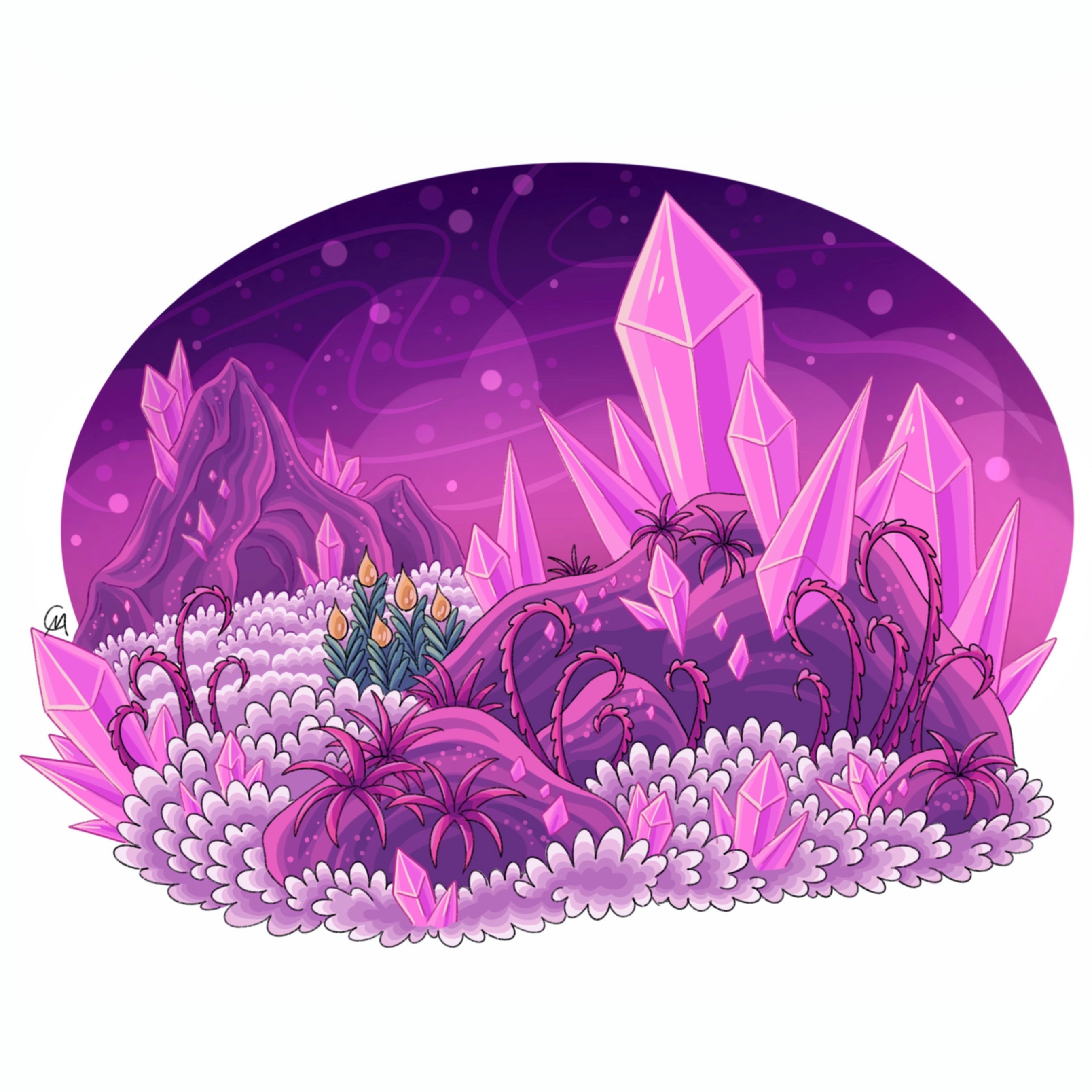
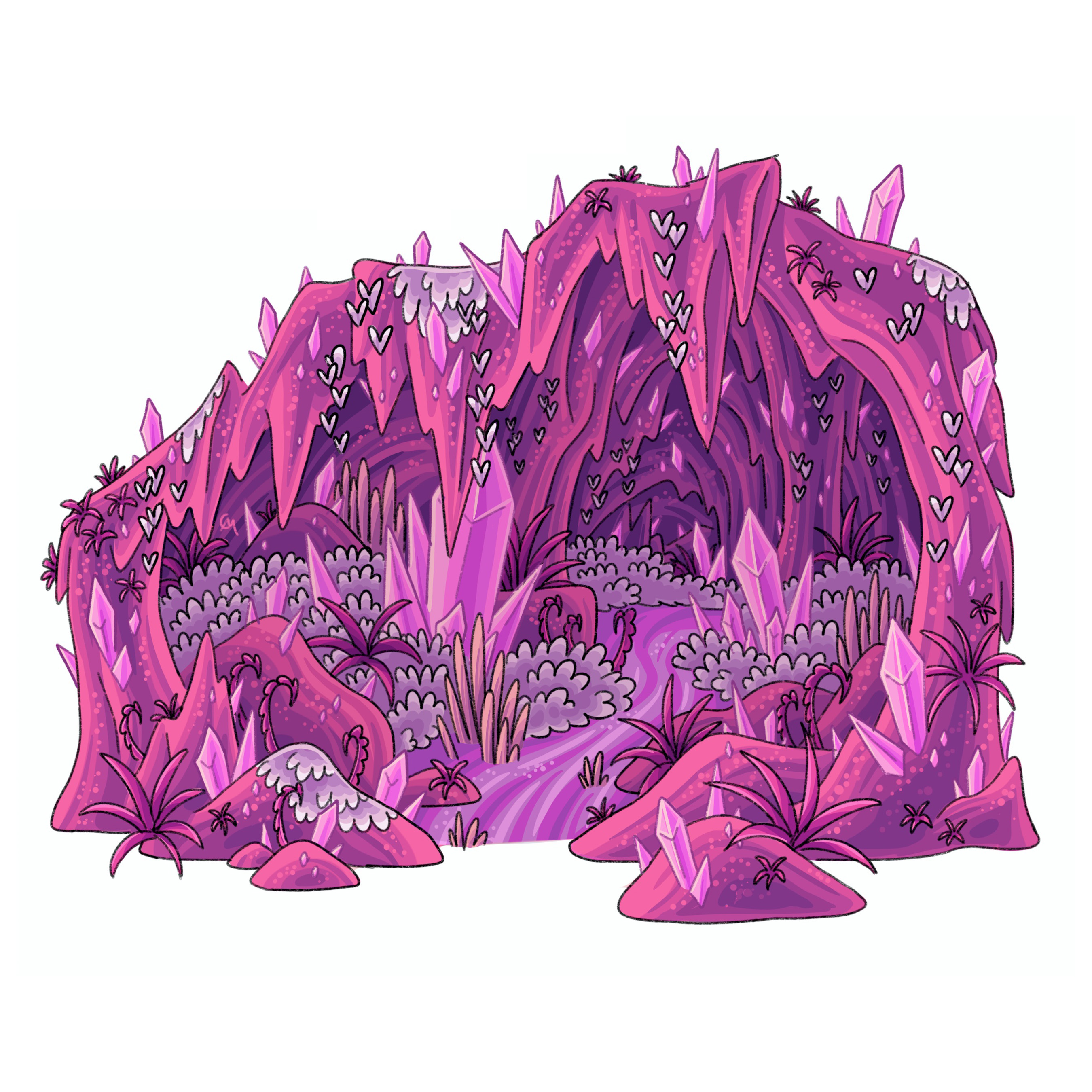
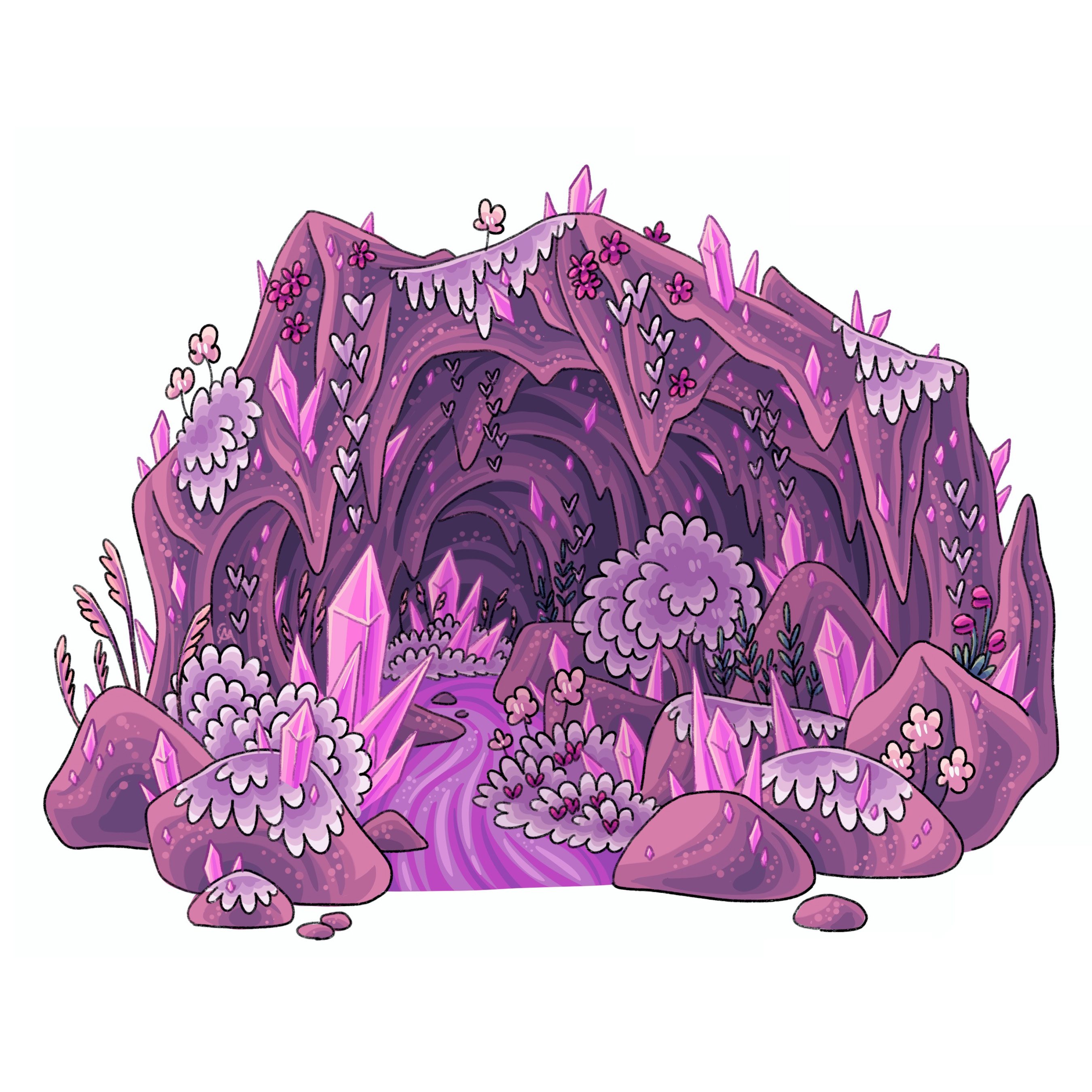
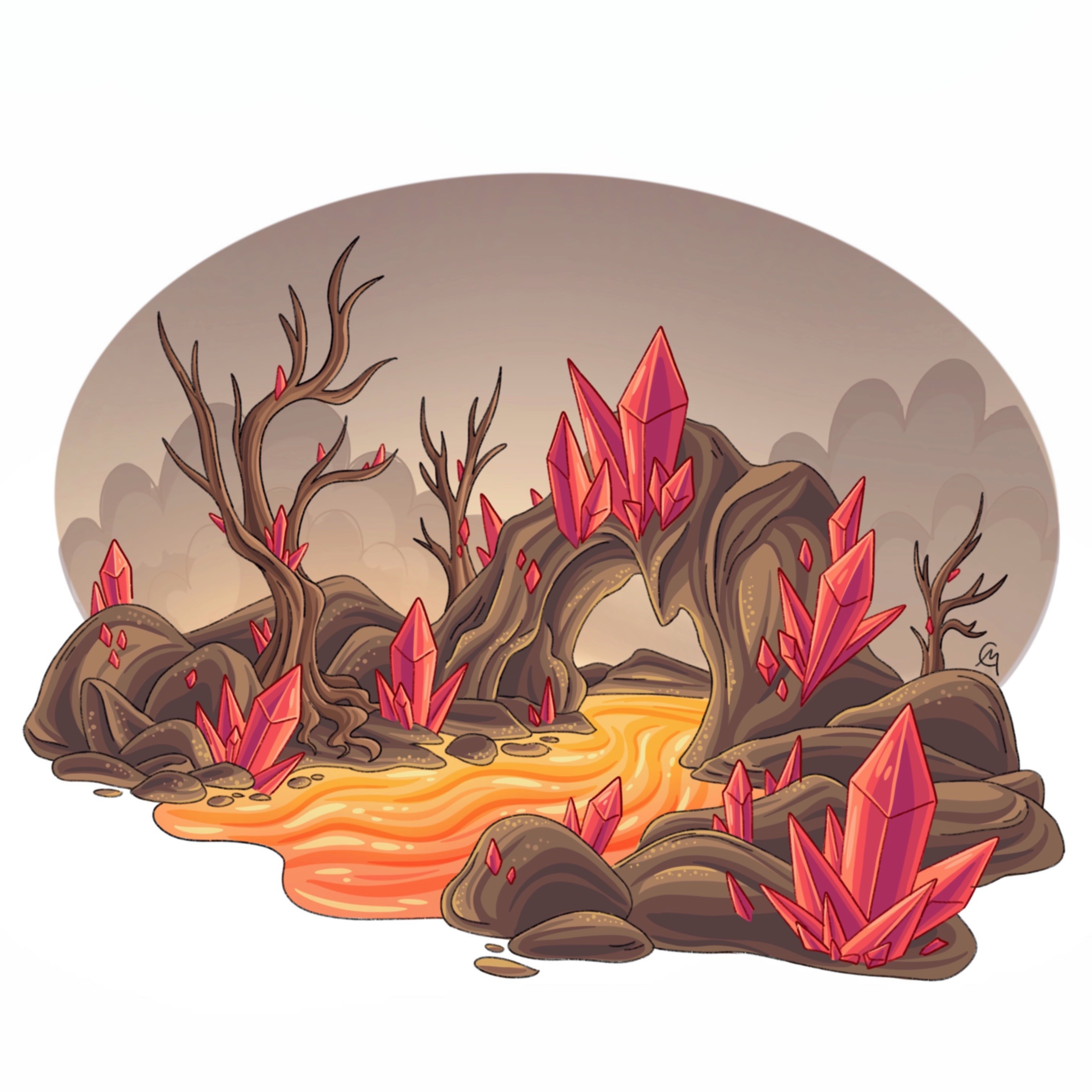
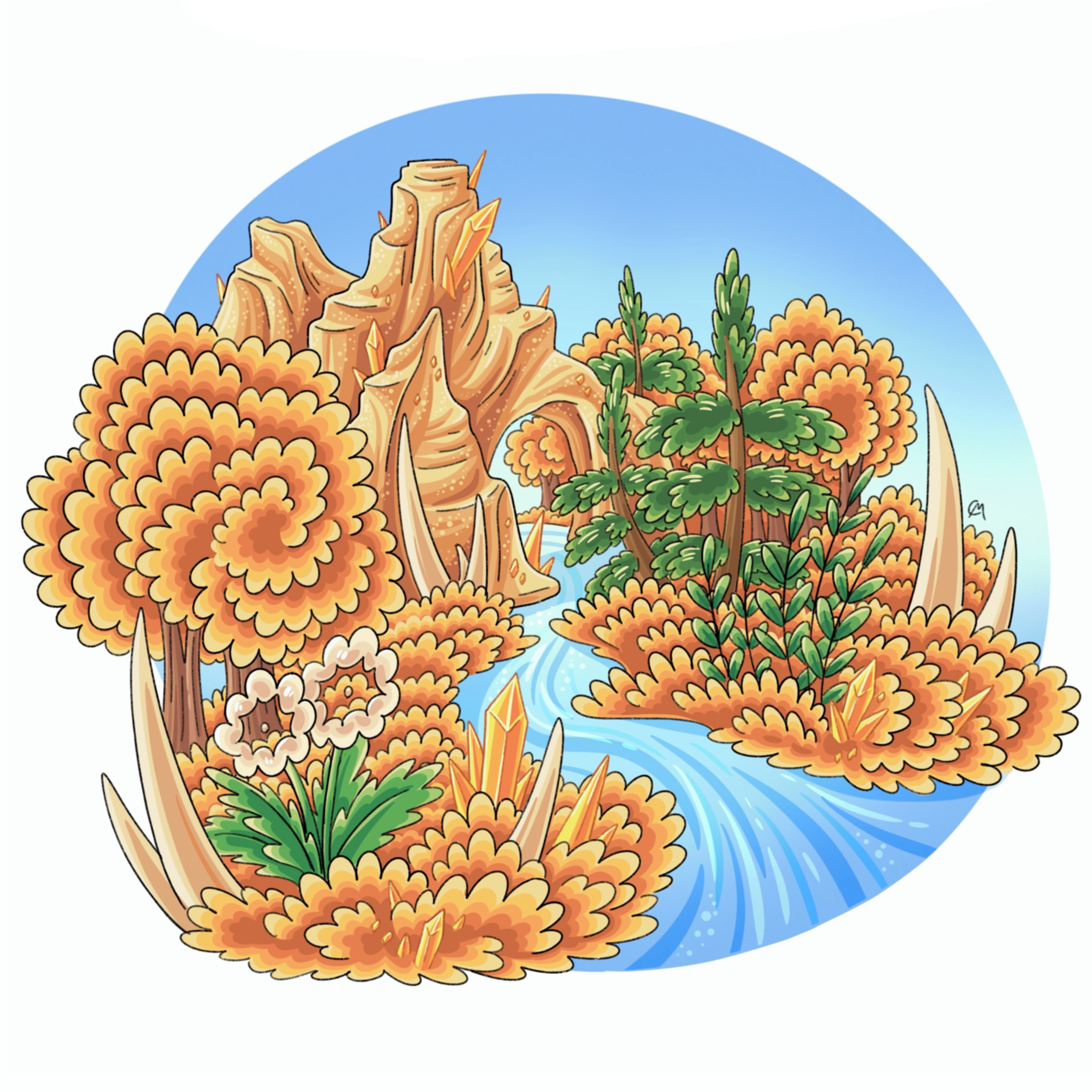
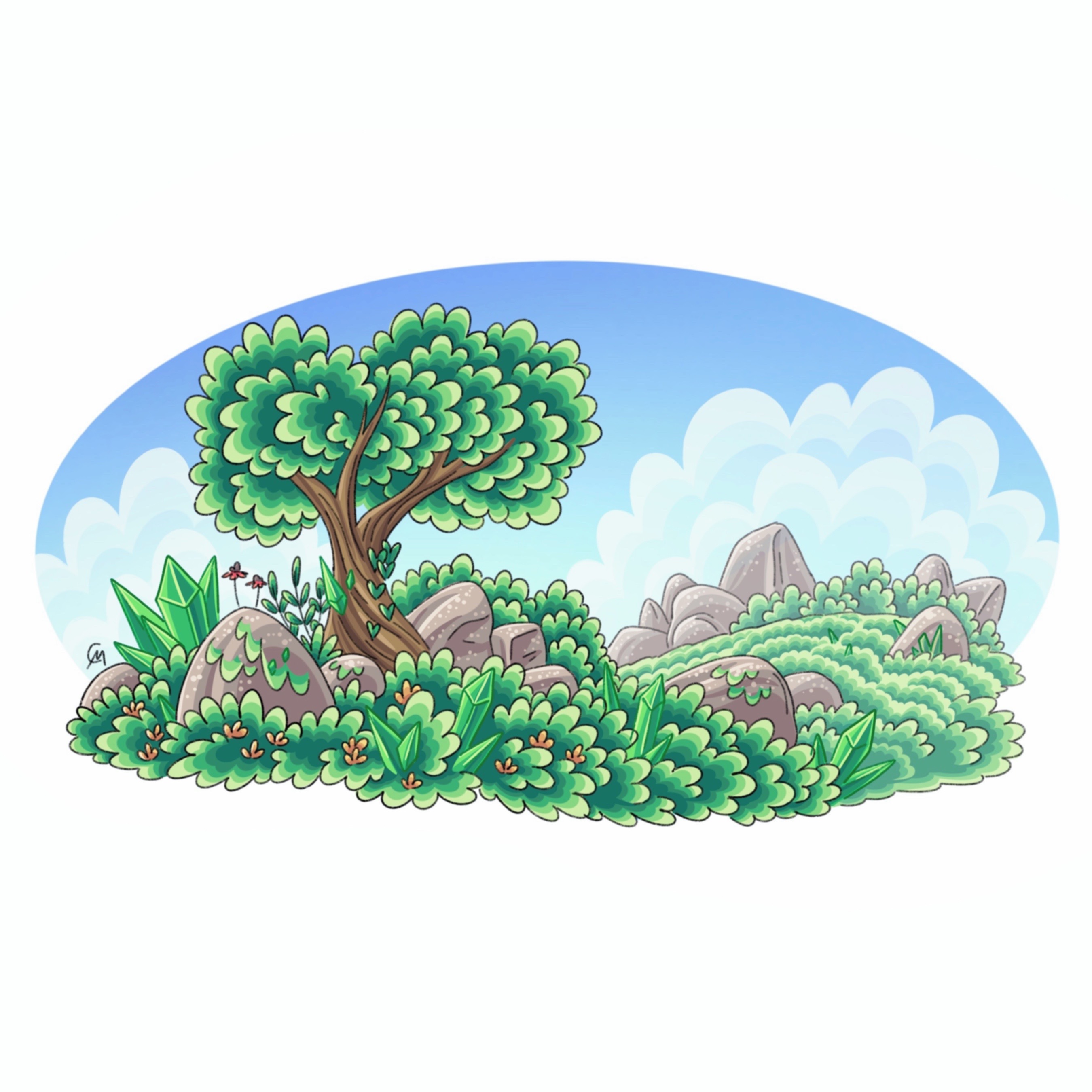
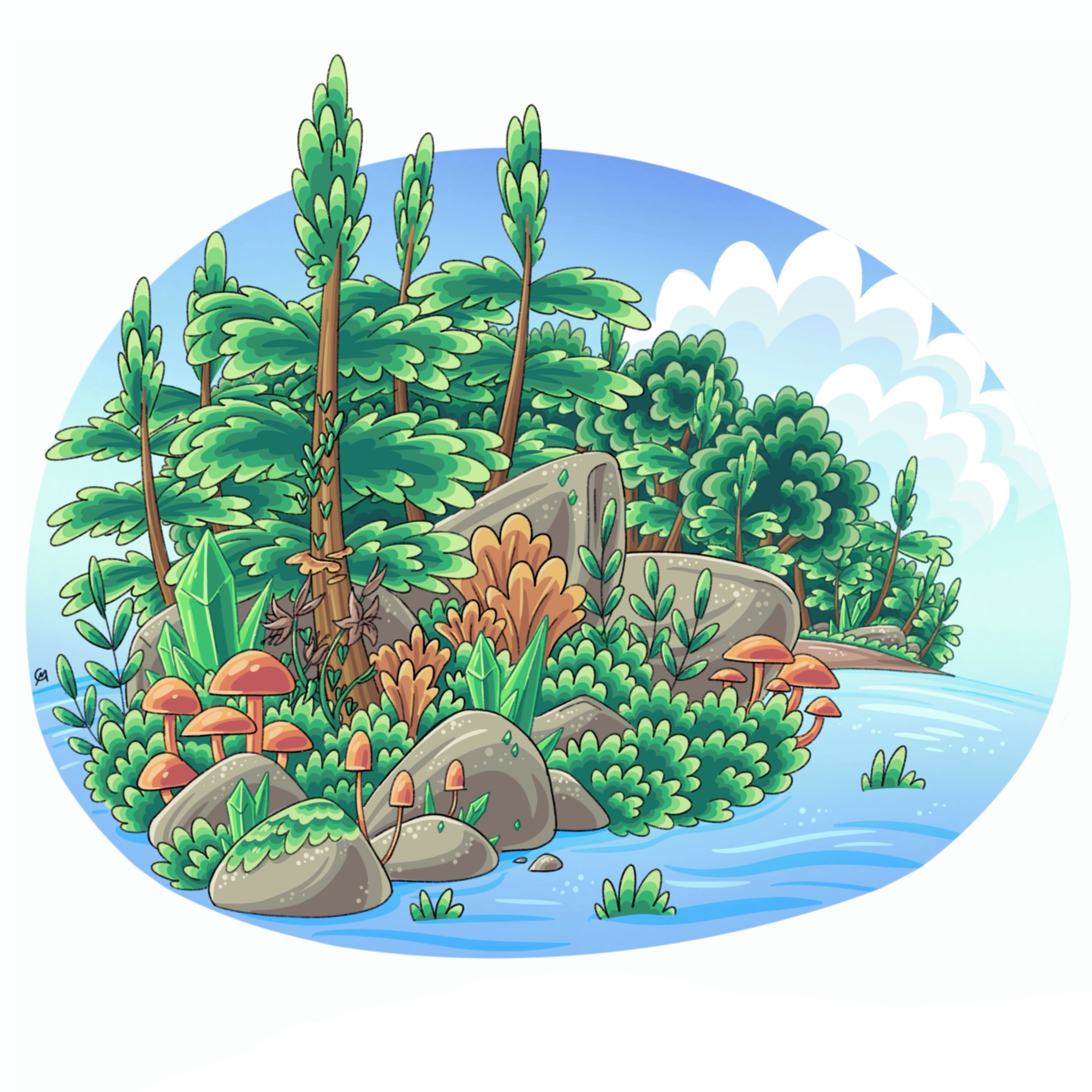
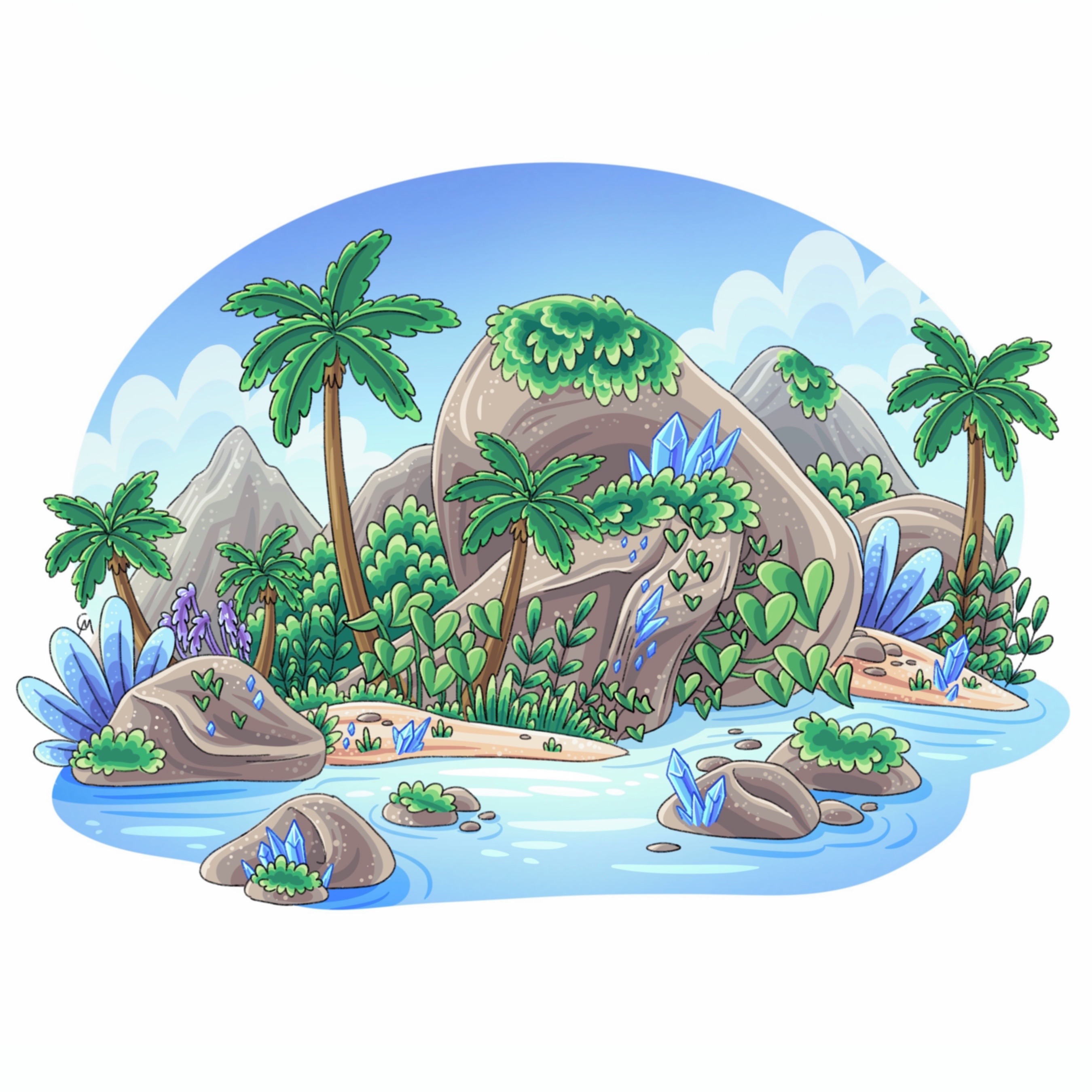
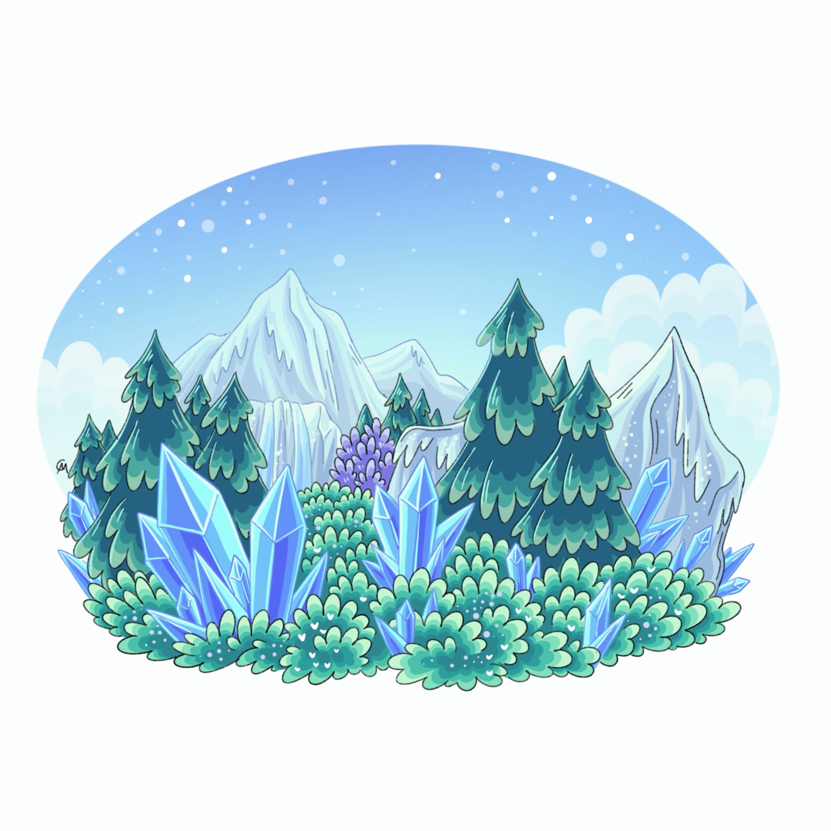
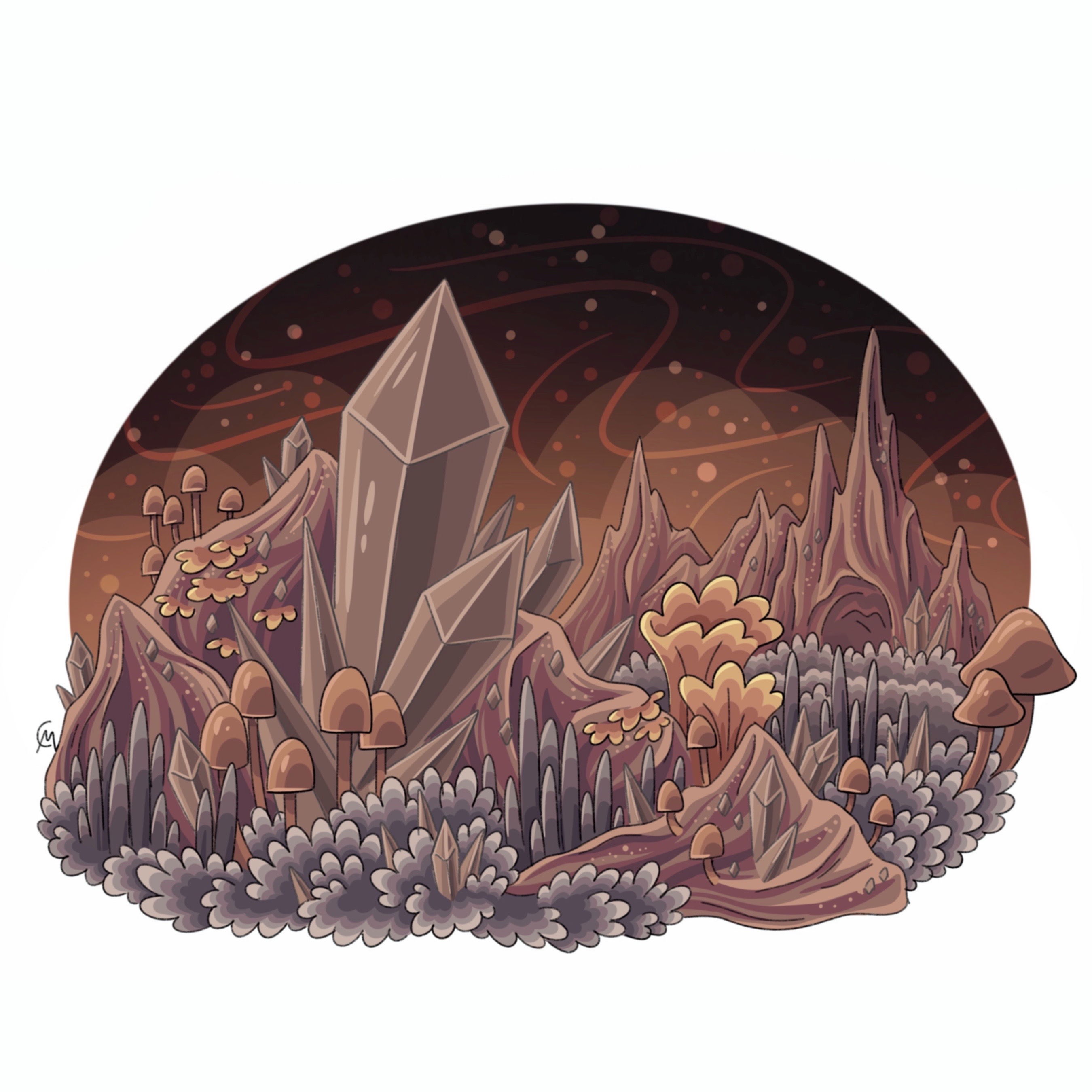
Aeon Caves
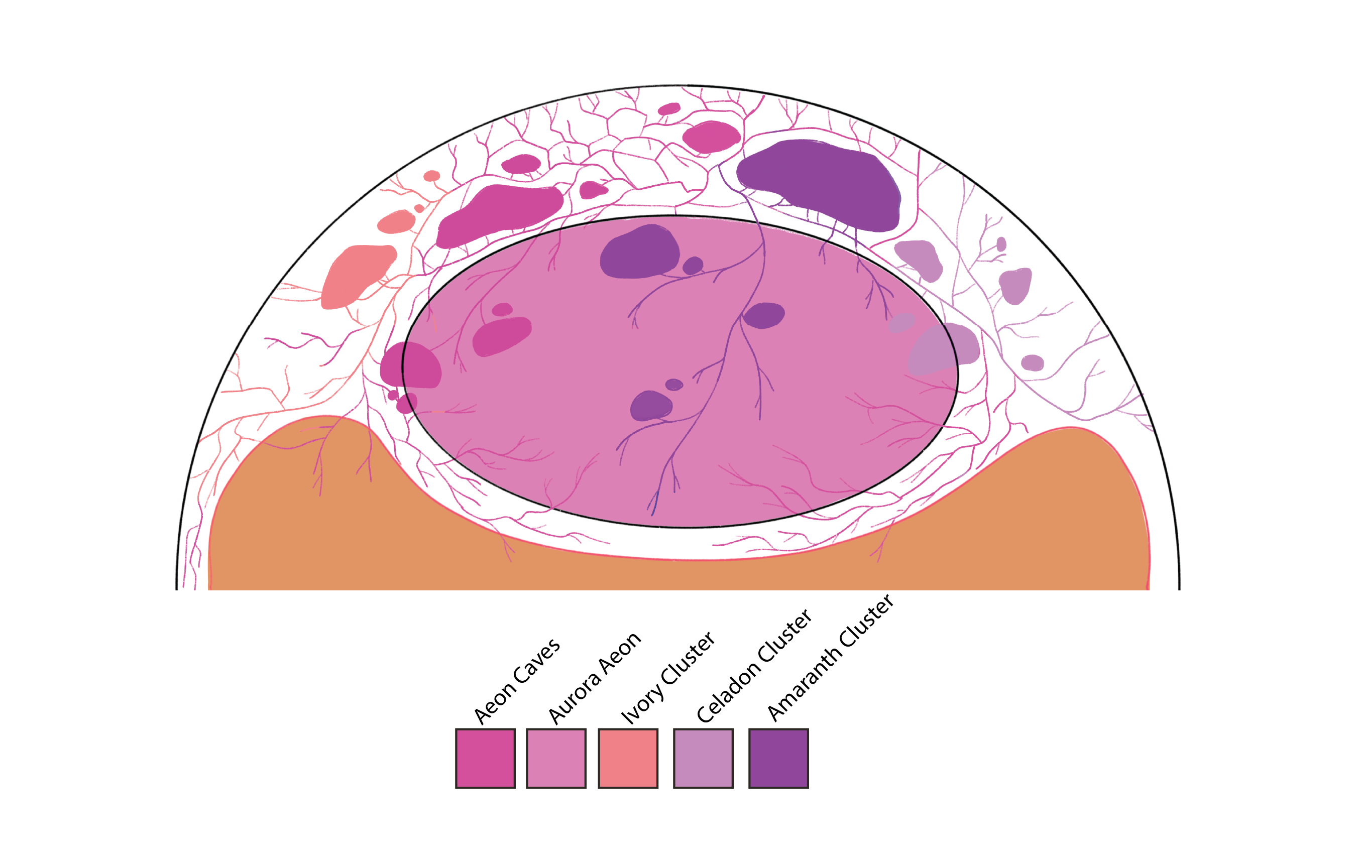
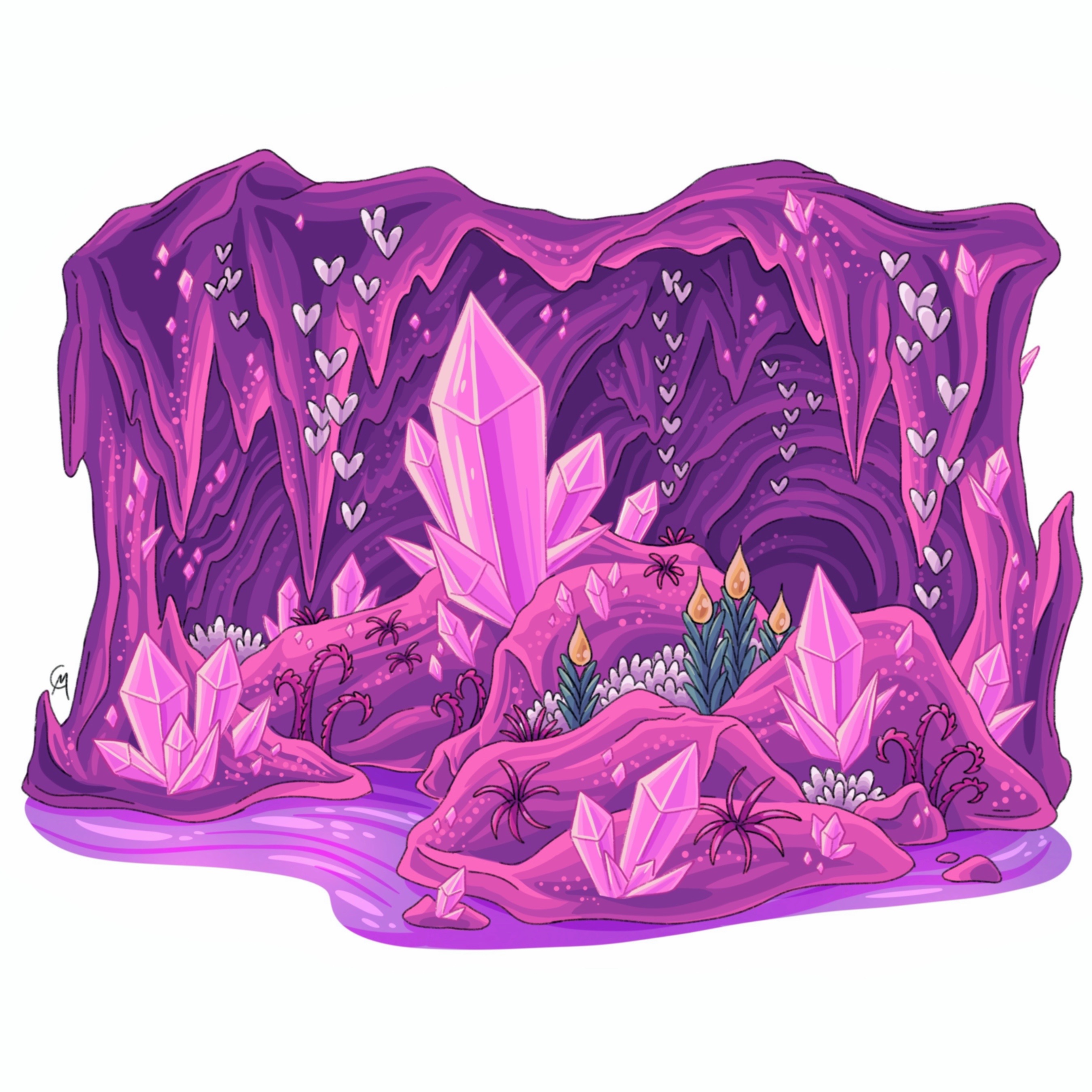
Aeon Caves
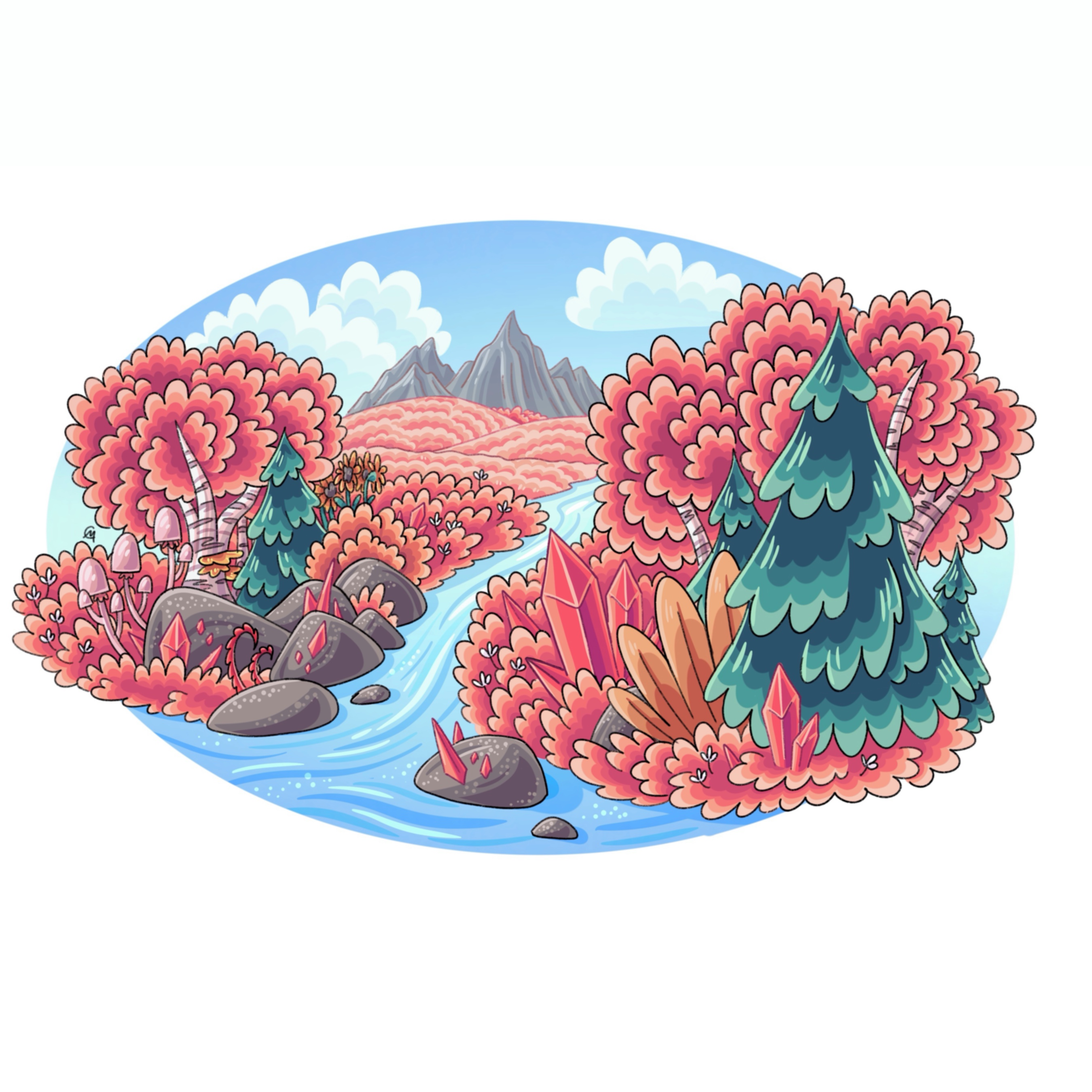
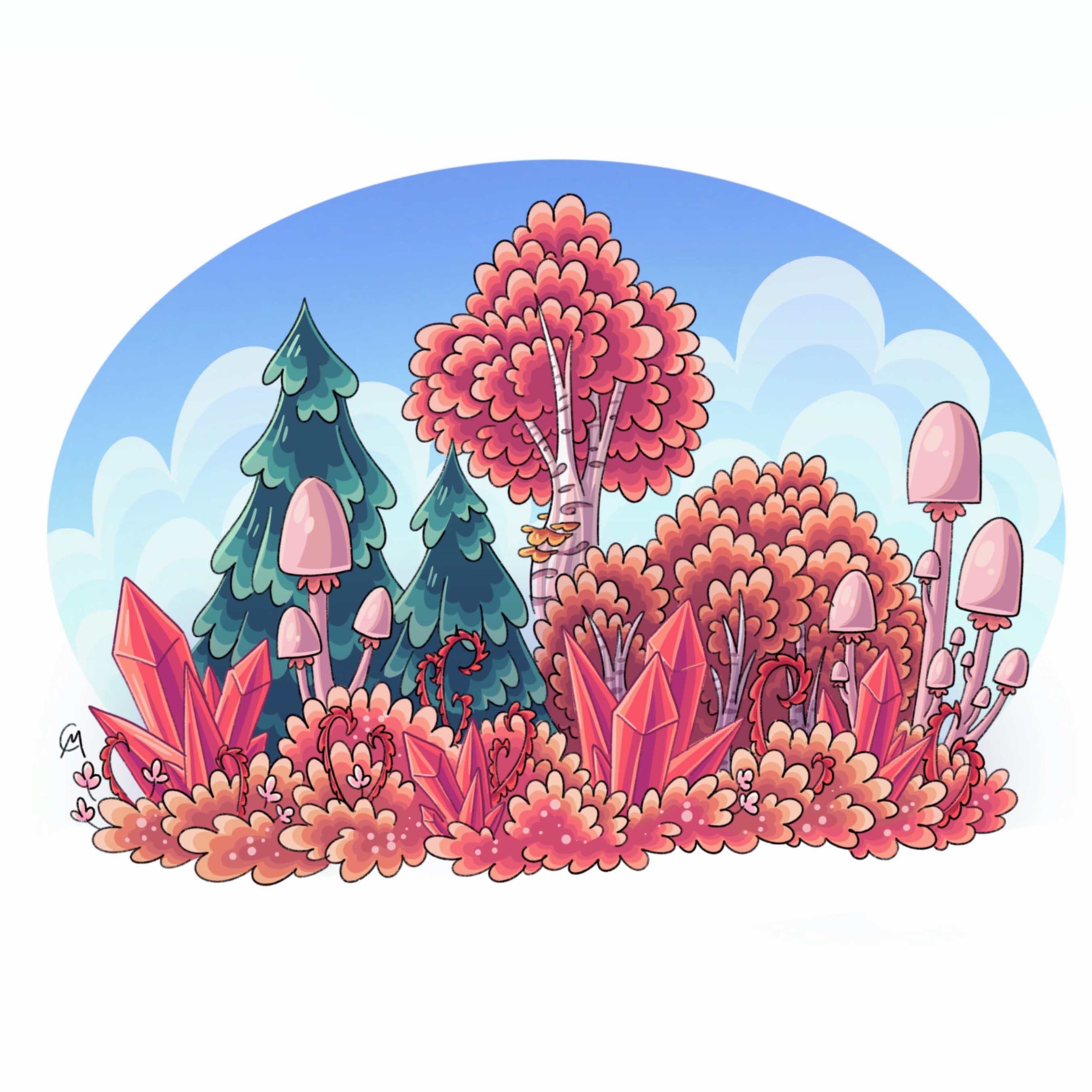
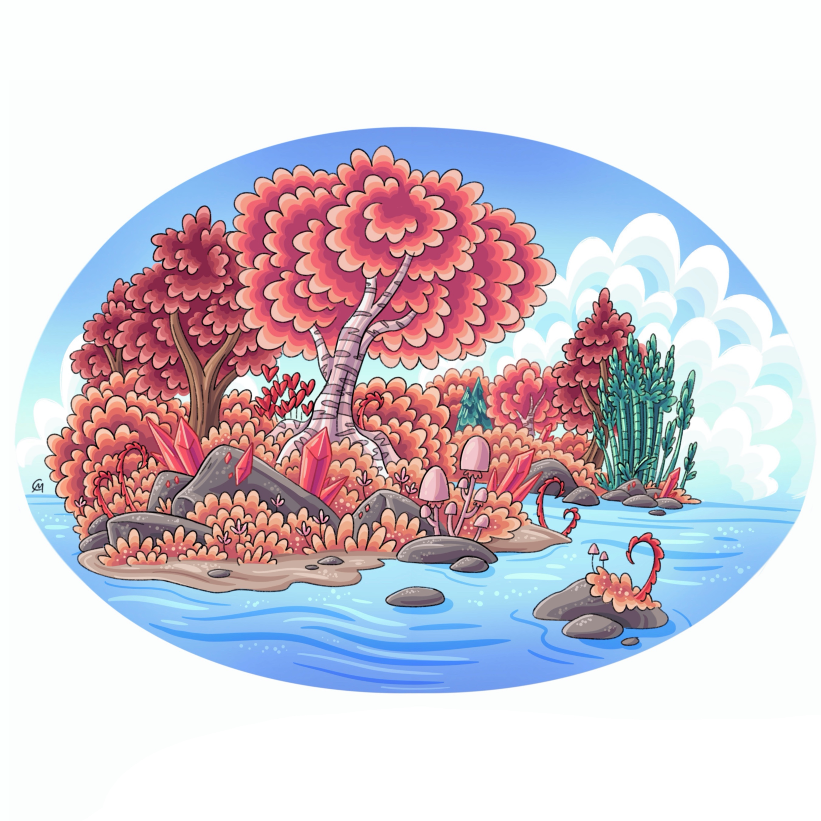
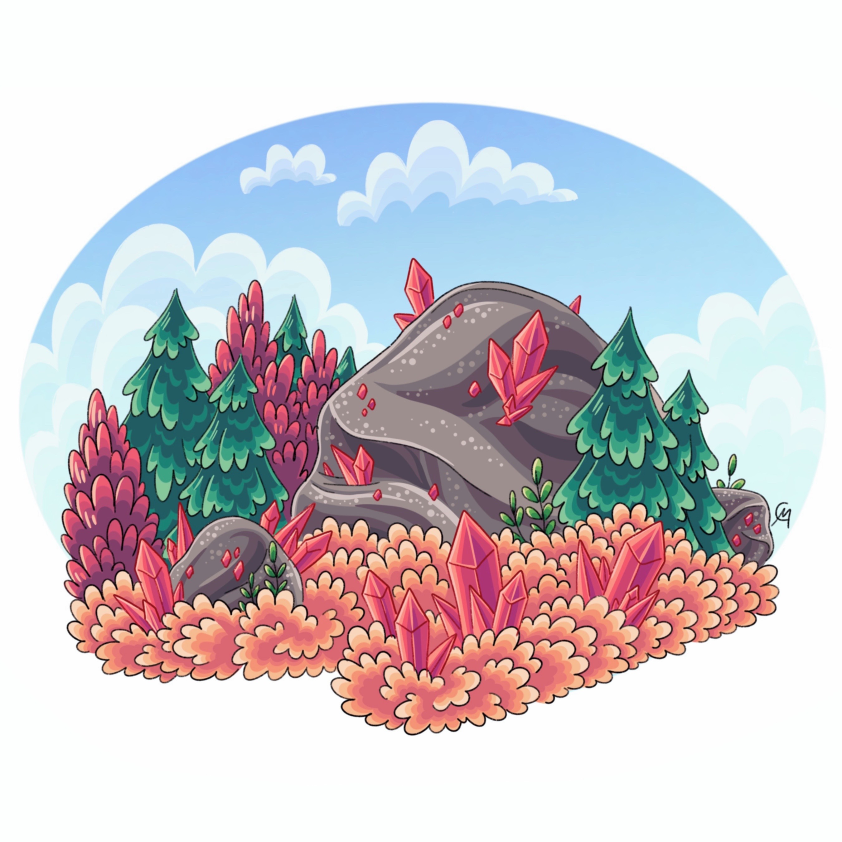
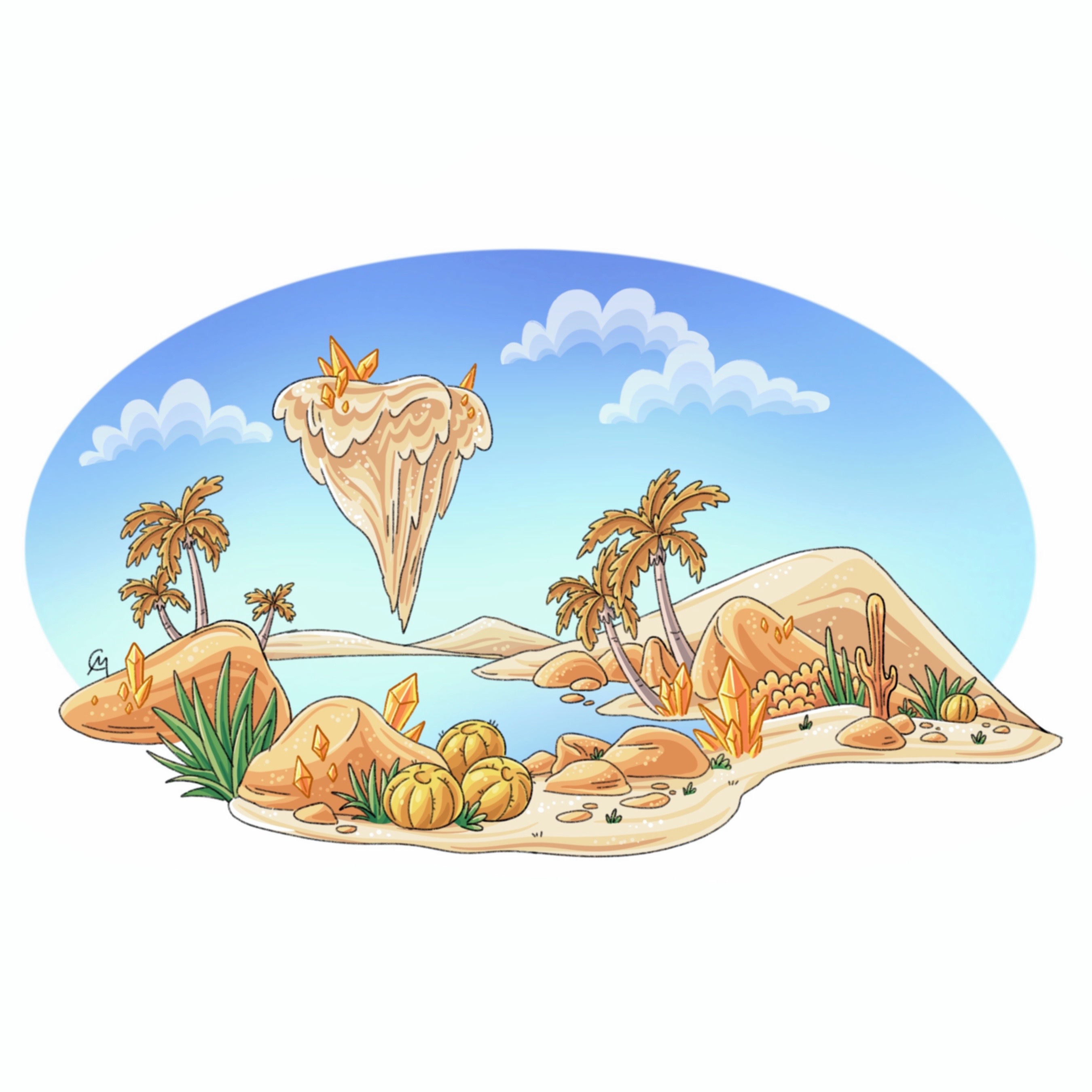
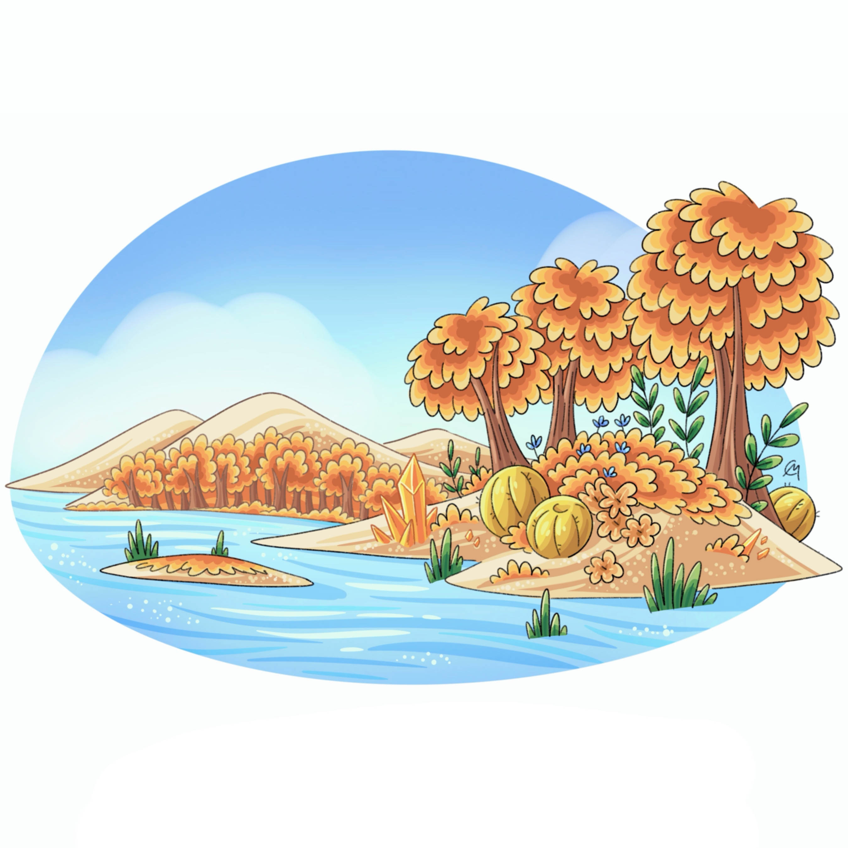
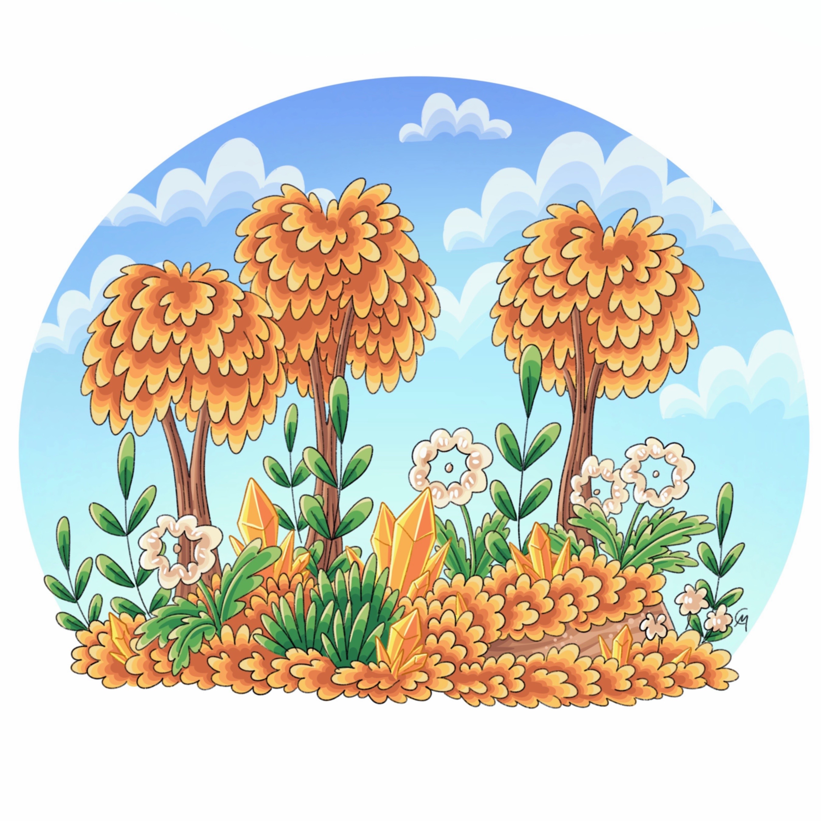
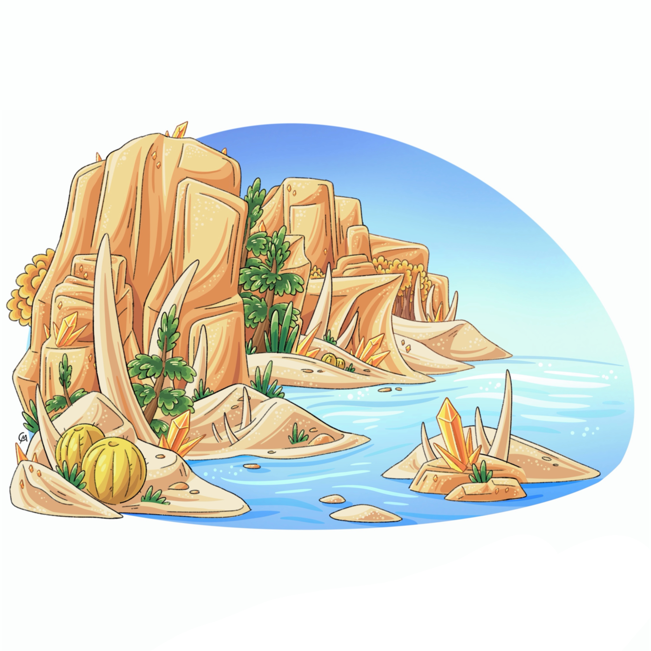
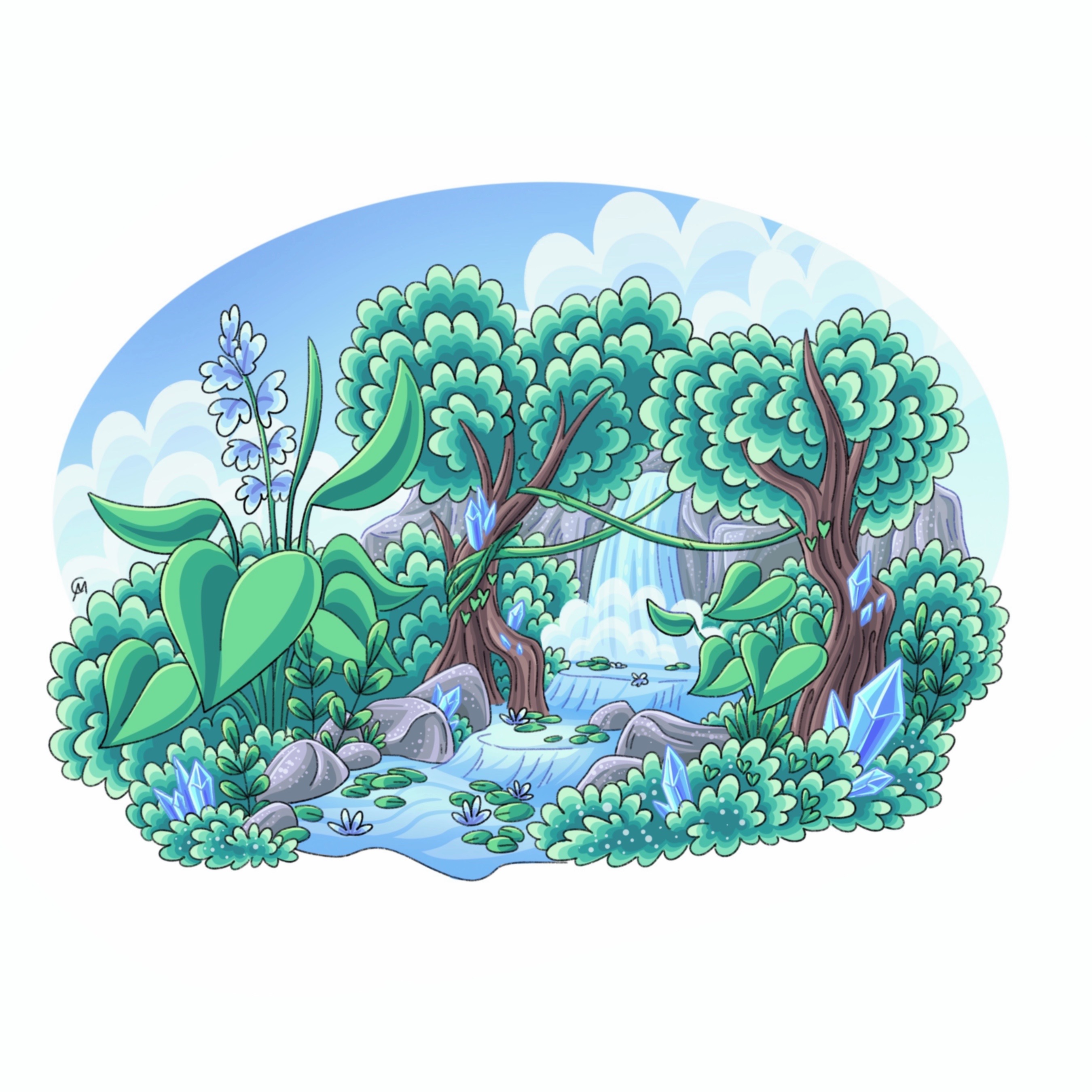
The Aeon Caves are an expansive cave system that exists underneath the northern hemisphere. Aeon caves, known for its bright tunnels and caverns, a plethora of giant pink crystals, distinct cave plant/animal life and the prevalence of light spirits is a hidden world full of beauty and lightness. These caves stretch millions of miles, bordering three continents, with many undiscovered and unexplored branches. Every cave, branch, cavern is unique and not found anywhere else, with varying temperature, humidity, and biodiversity.
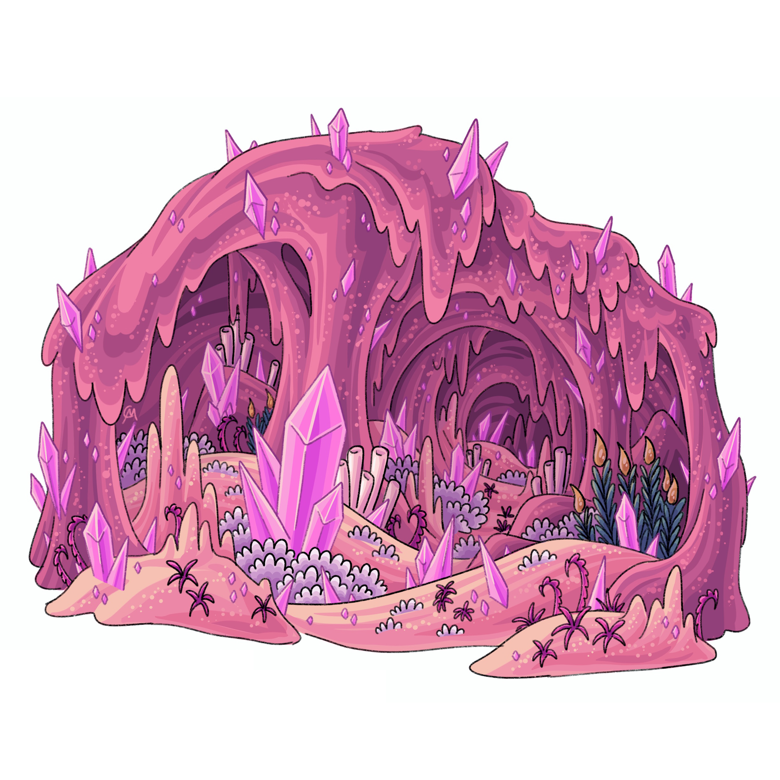
Aeons
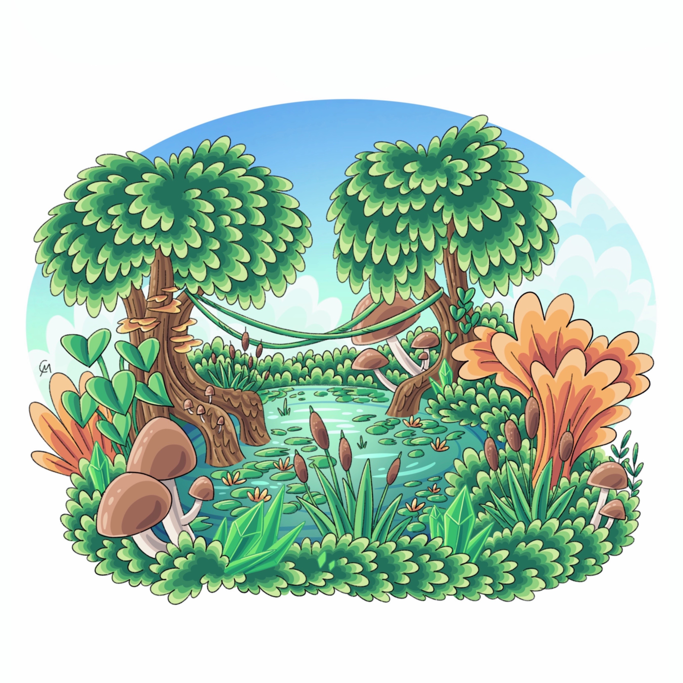
Aeons are giant subterranean cavities that exist within Terra’s northern hemisphere. They can range from a few miles to hundreds of miles across. Because of their sheer size, these aeons can host an atmosphere of their own where it’s nearly impossible to look up and see the subterranean ceiling. Aeons are typically covered in a blanket of pale “grass”, scattered ponds/lakes, and are filled with bustling spirits. They reflect the day/night time cycles seen on the surface as spiritual activity brightens the “sky” during the day and darkens it at night. These biomes are where most people in The Aeon Caves (the country) live as major cities have taken advantage of the sheer size and geography of these Aeons which made it easy to grow and develop into megapolises. The largest aeon, the Aurora Aeon, is home to the light Goddess Opal and her God Crystal.
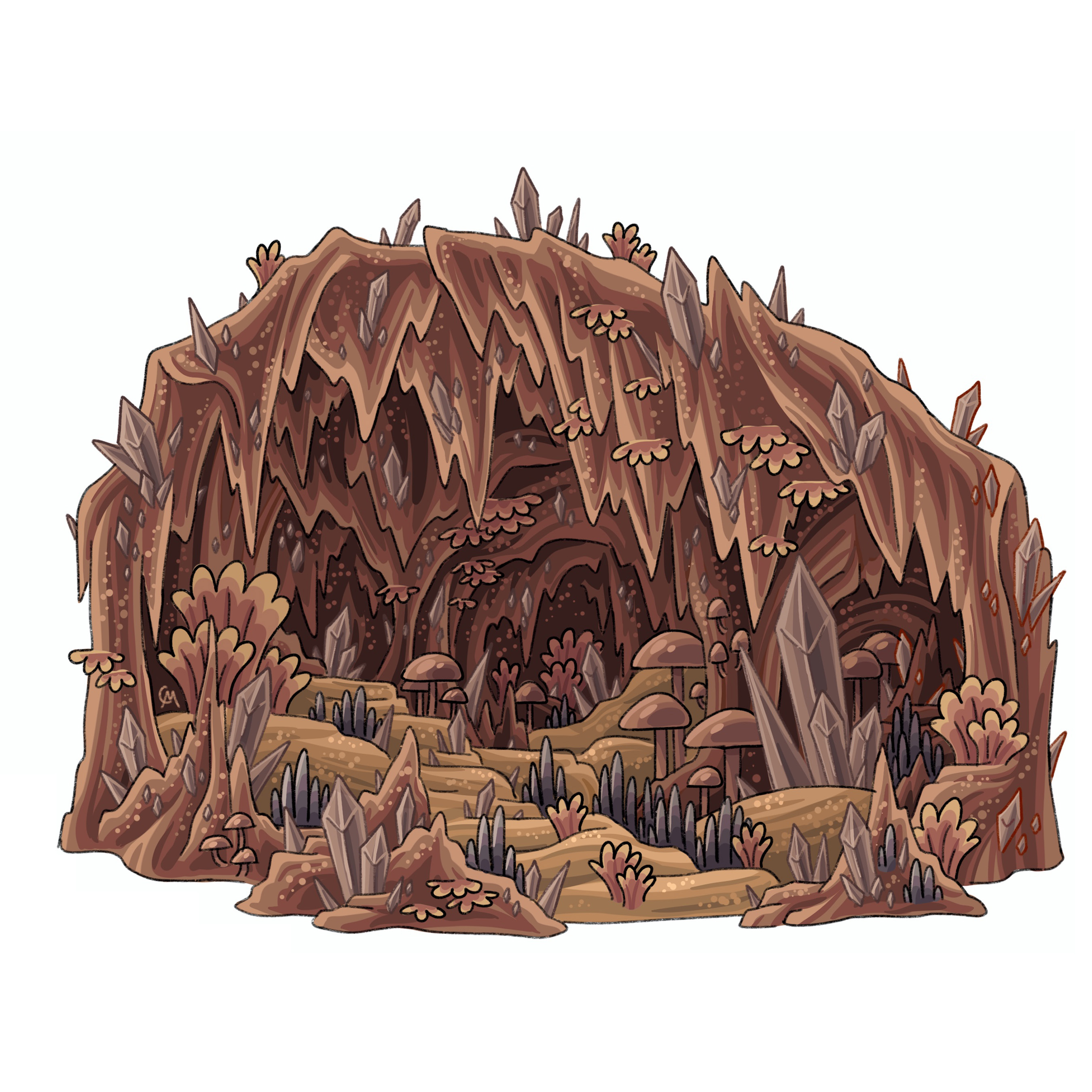
Amaranth Cluster
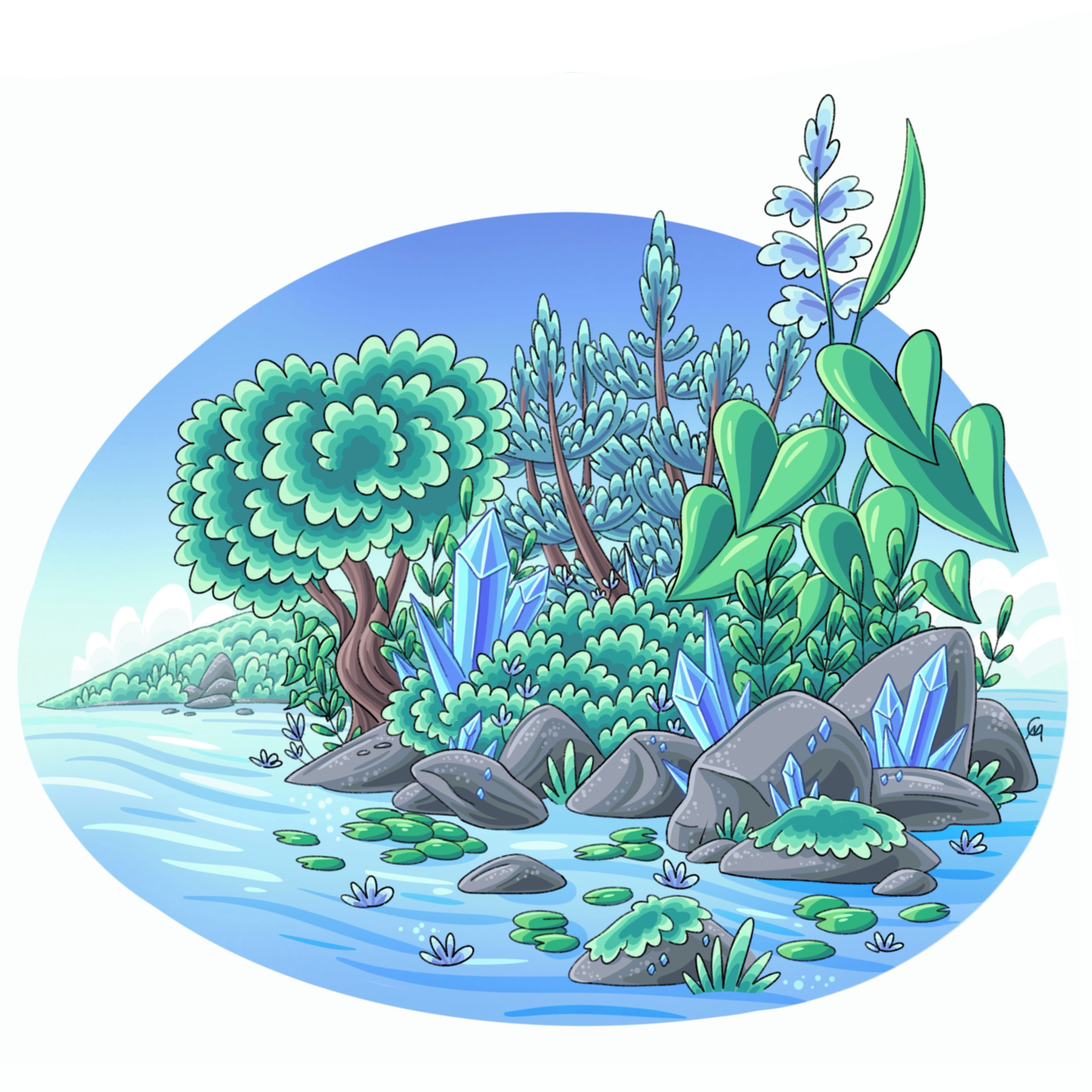
The Amaranth Cluster is a cluster of aeons and caves located underneath the continent Emberland and it stretches to encompass the branches that stretch to the equatorial Sapphire Islands. At first glance, this cluster most resembles the typical aeon caves found in the north, but traveling along the Aura Branch to the tropical paradise, this cluster springs to life. Very lush, with running streams and raging waterfalls, this cluster features the most diversity in life in any cave system. Spirits rage on in caves and caverns as they would in spacious aeons which makes traversing this cluster dangerous as these spirits produce blinding lights that can cause disorientation and temporary blindness. The branch connecting the Sapphire Islands and the rest of the Aeon Caves was impossible to cross, but in the modern age of high speed rail and excavation technology this barrier was crossed.
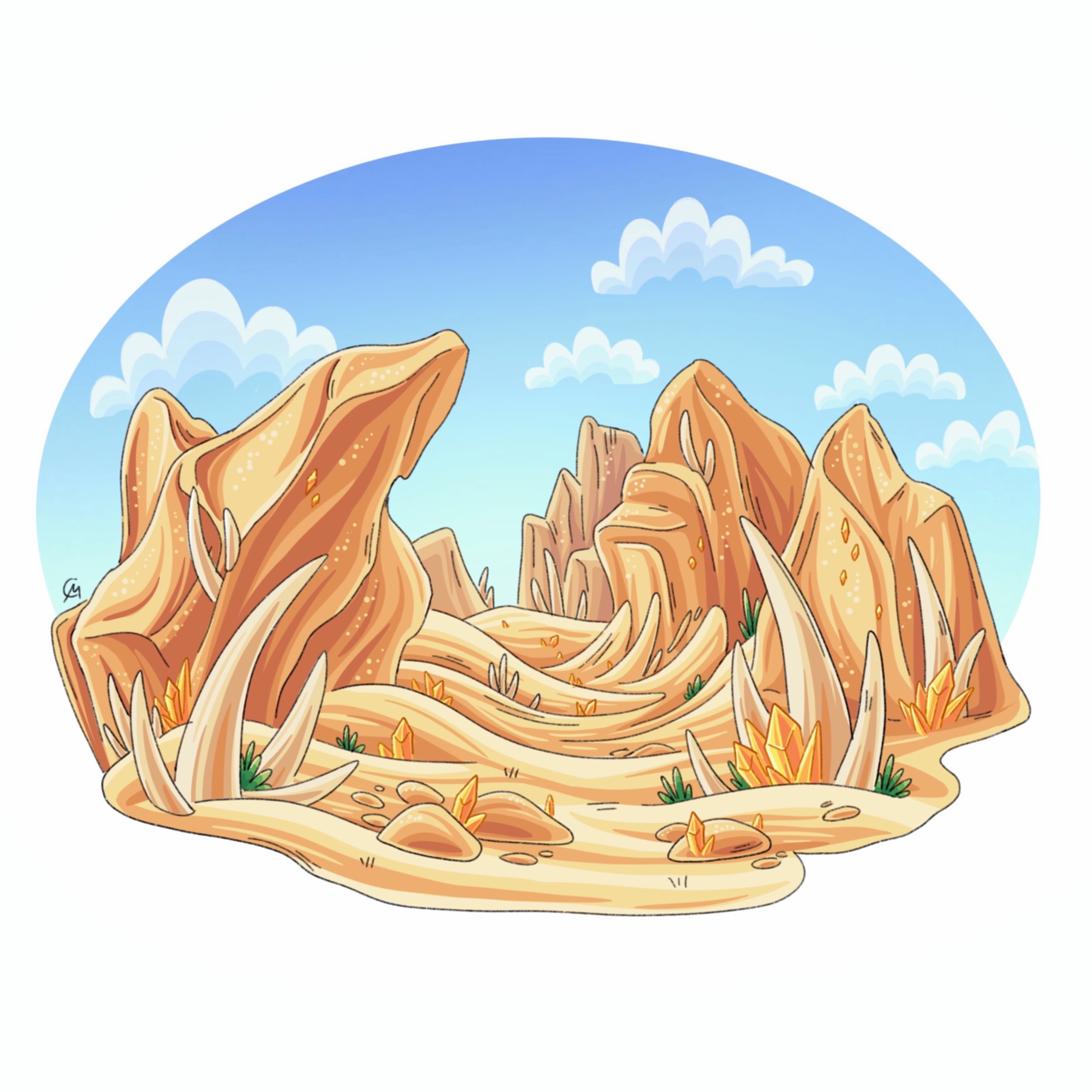
Ivory Cluster
The Ivory Cluster is a cluster of aeons and caves located underneath the northern half of the continent Aerodona. This cluster is known for its lack of humidity which makes this cluster notorious for its lack of vegetation, dry water wells, and fine sediment that can create dust clouds leading to a lack of visibility which can be dangerous inside branches and caverns. This fine sediment is a mixture of Aerodonan sands, blown in from cave entrances, eroded cavern walls from the gusts of wind that enter the depths and smooth out jagged edges, and old crystals that failed to decompose due to a lack of crystal-eating organisms. These differences are merely “surface” level as the further you go into this cluster the more it resembles typical aeon caves as the erosive abilities of the wind fade away.
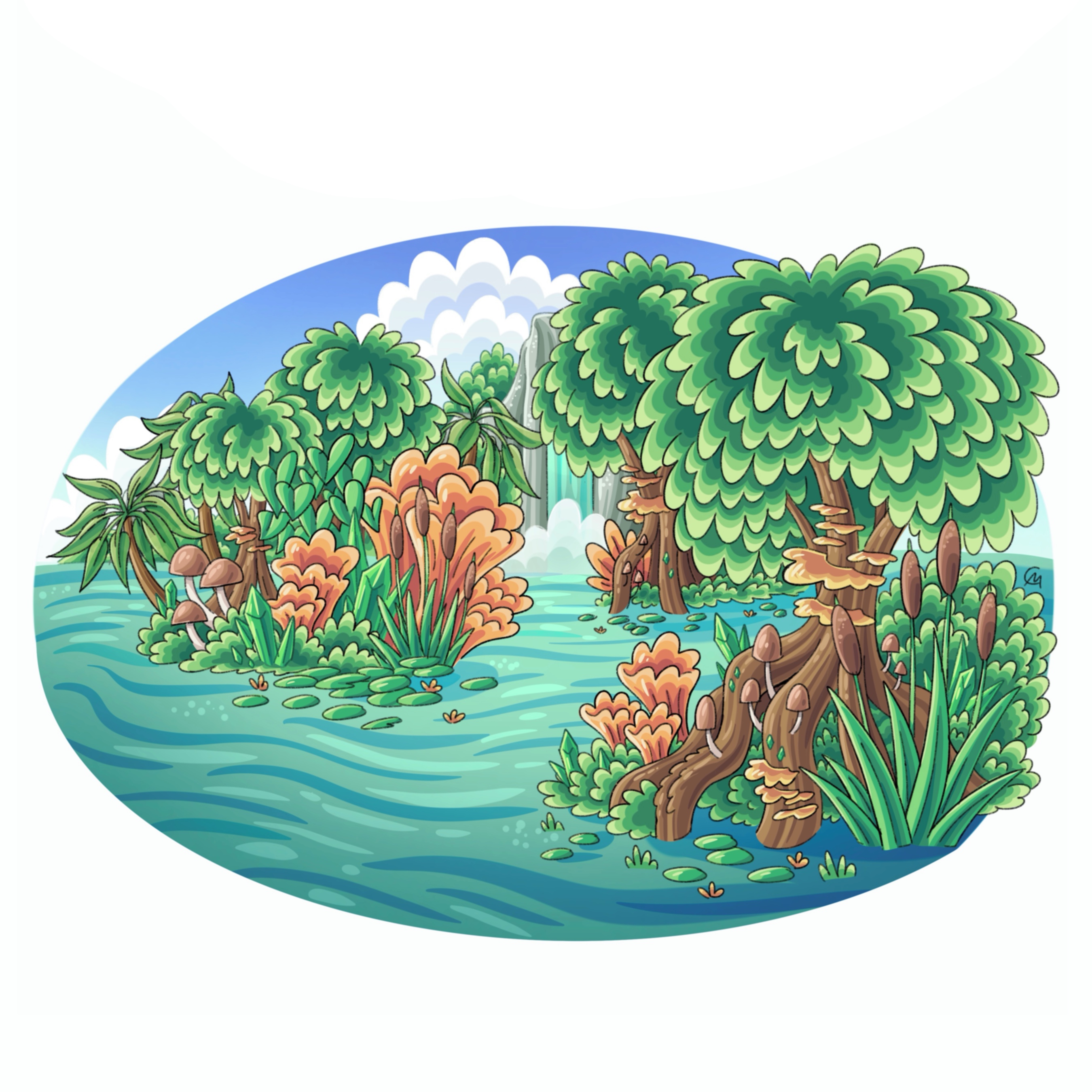
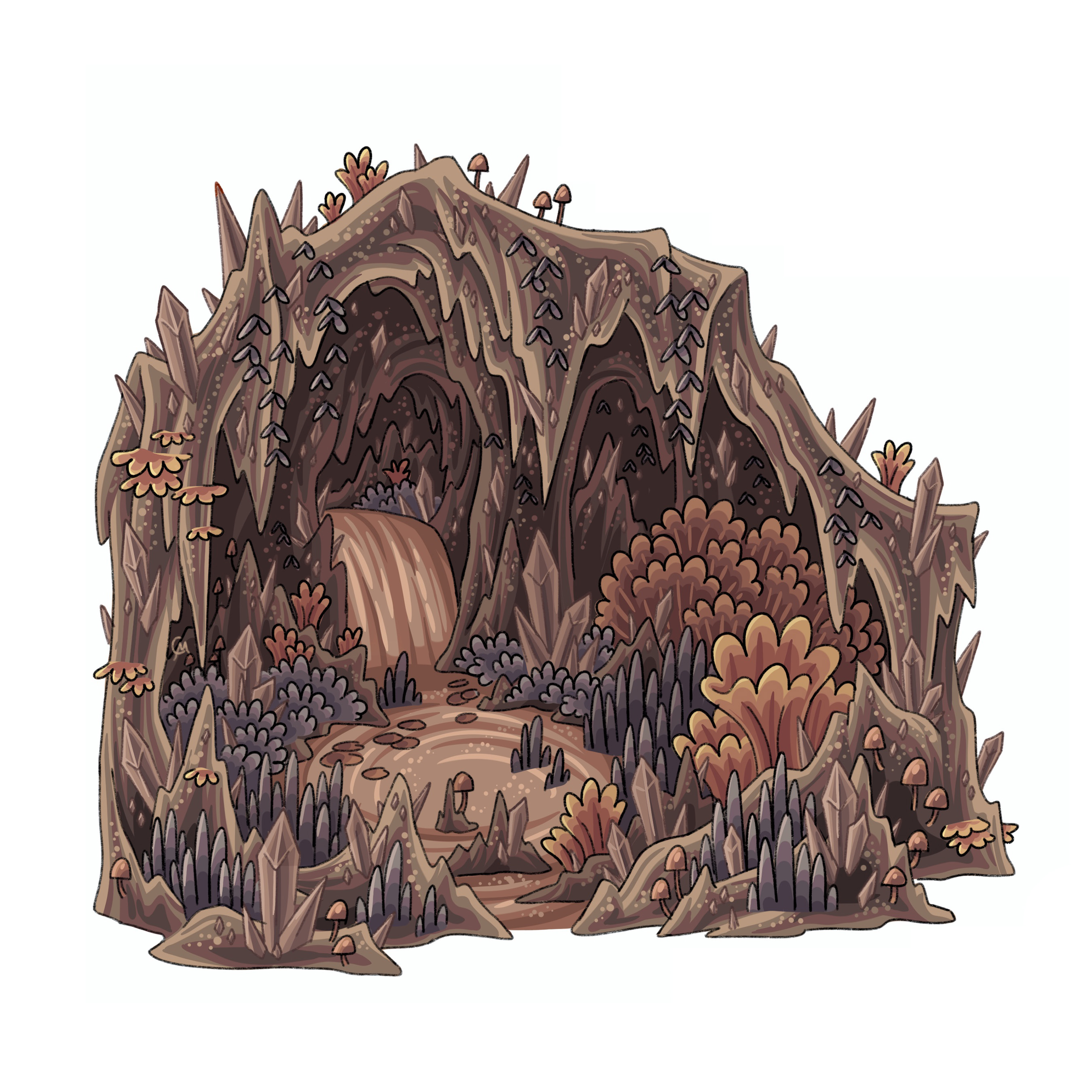
Celadon Cluster
The Celadon Cluster is a cluster of aeons and caves located underneath the northern half of the continent Vergund. This cluster is known for its overgrown, humid environment, with mosses and lichen crawling up cavern walls, dense fog that can obscure visibility, and flowing streams and waterfalls from the surface above. Due to its high humidity, plant life has taken over this cluster, with some species originating from the surface. This also makes this cluster ideal for growing crops that would otherwise fail in the other clusters. Compared to the other clusters, this cluster has the least amount of surface entrances with the majority buried deep beneath the waves of the Flint Sea. Due to its environment, overgrowth, and water filled caverns, a lot of this cluster had remained unexplored until the recent search for Panacea’s eye.
Emberland
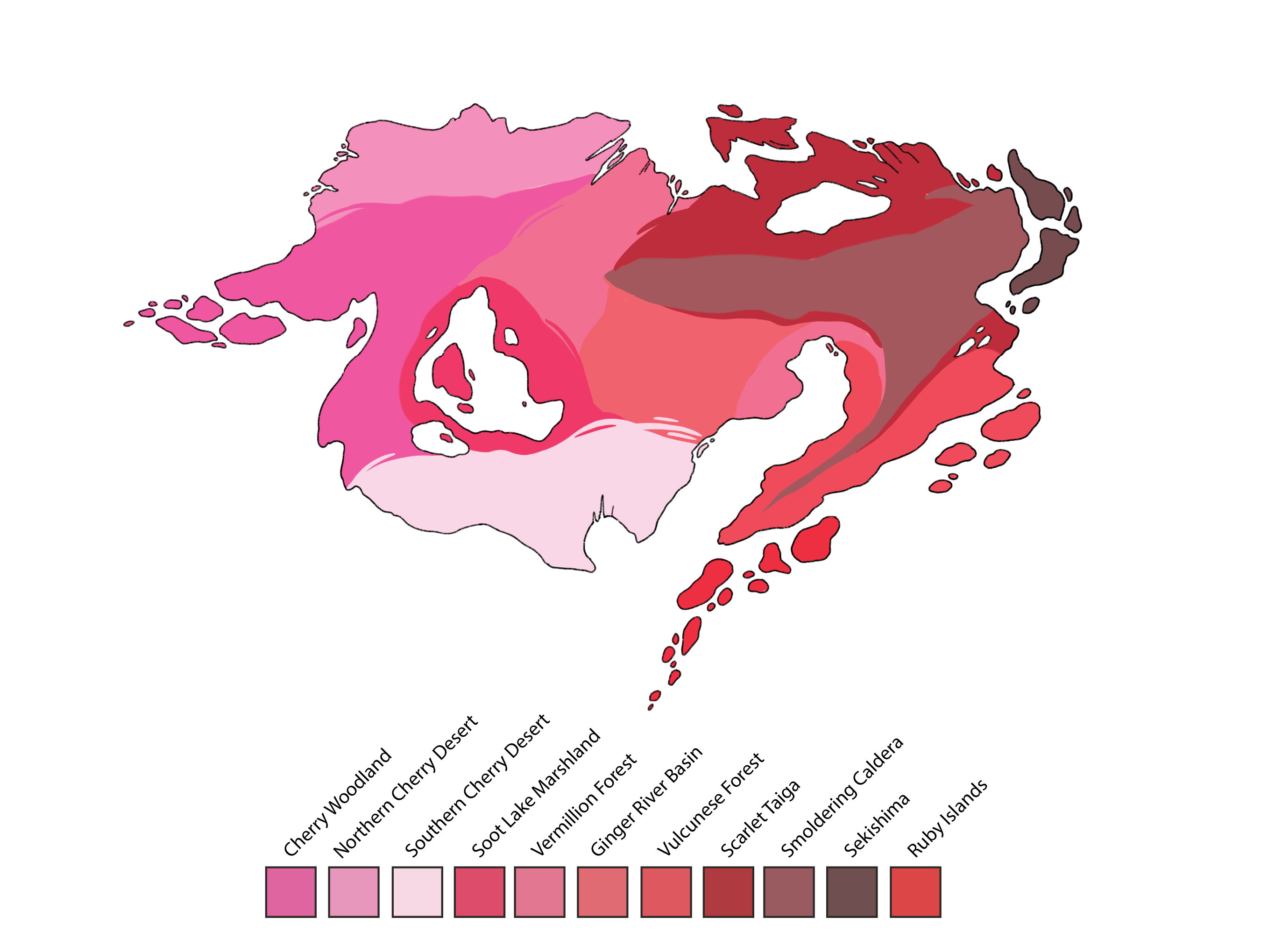
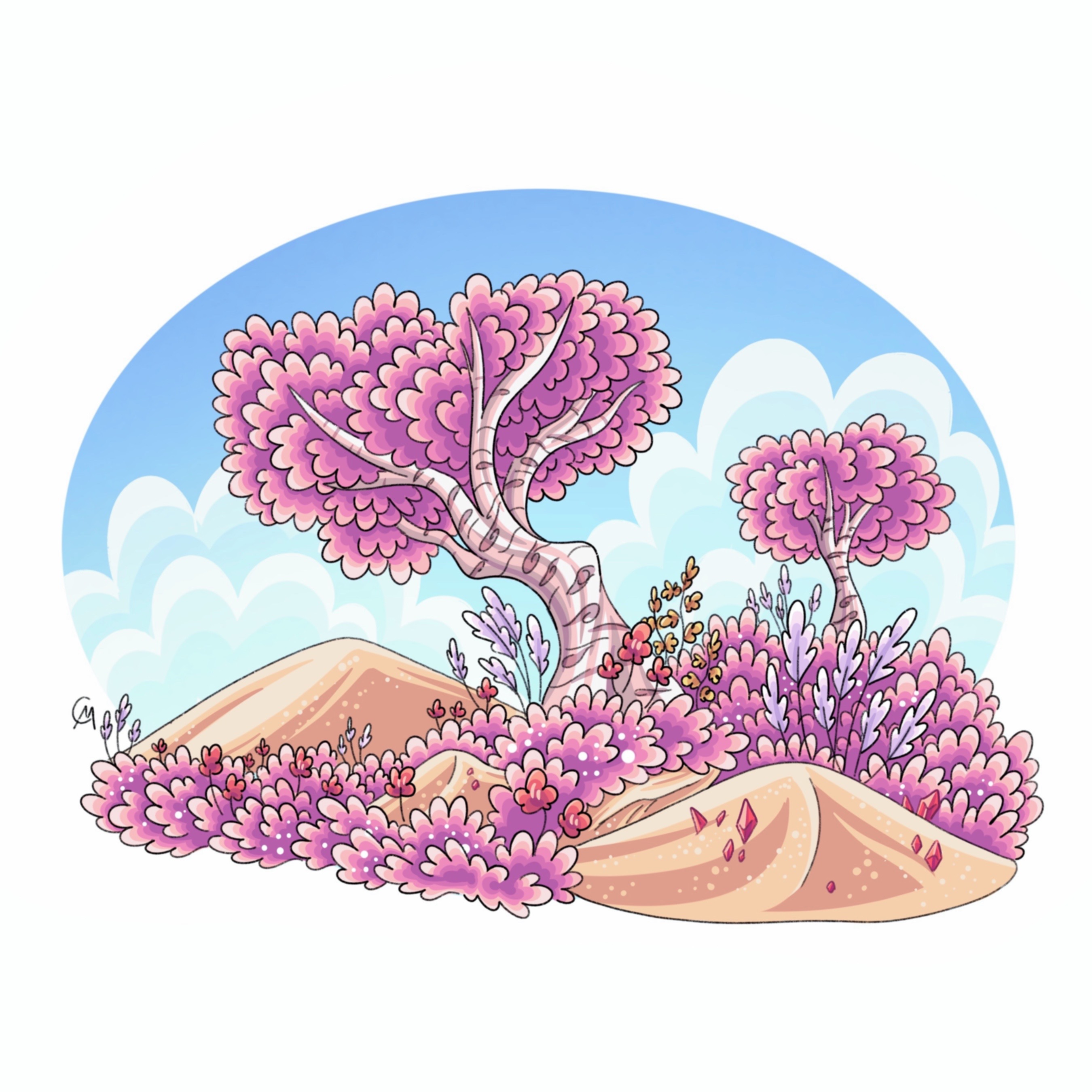
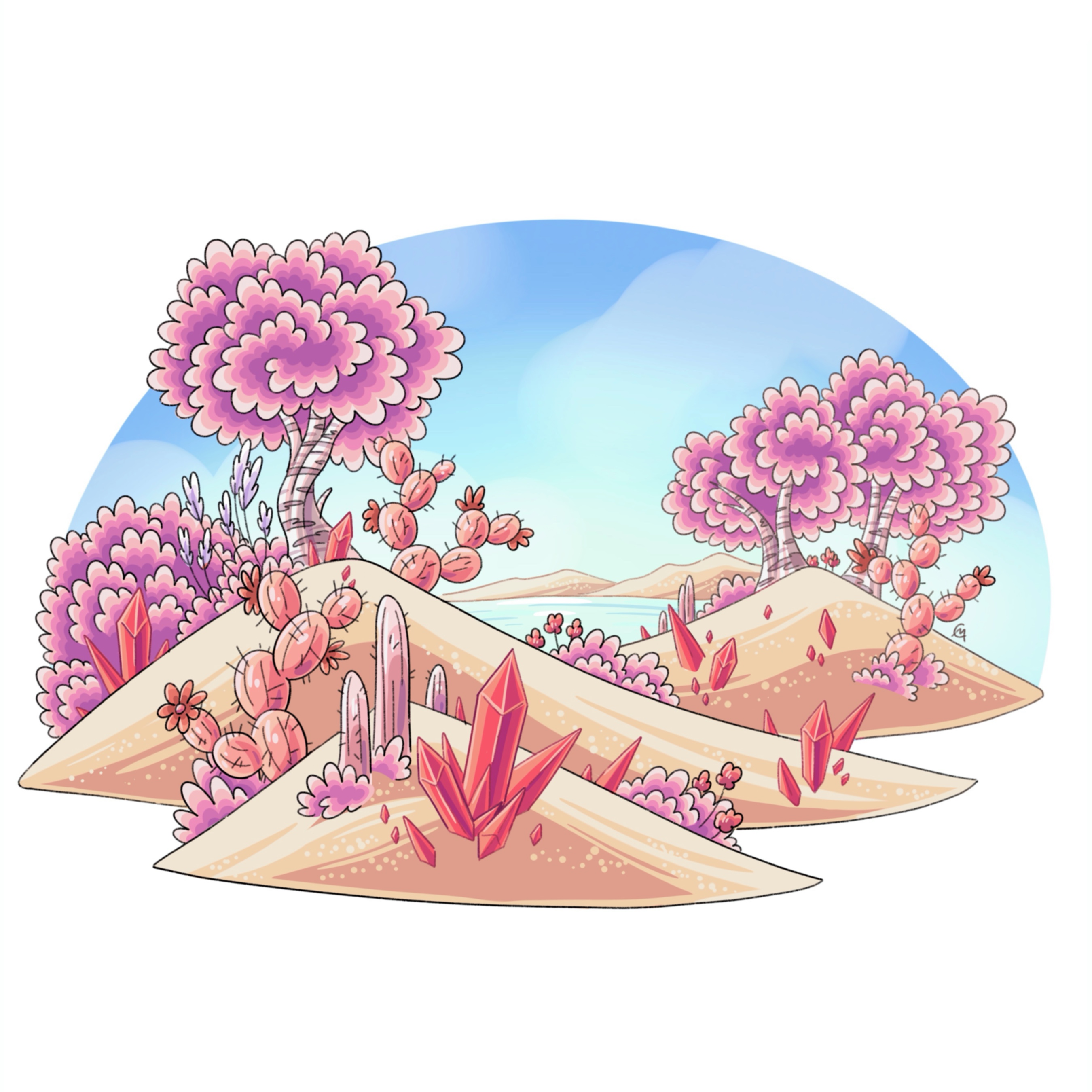
Cherry Woodland
The Cherry Woodlands is a large, sprawling biome within Eastern Emberland. White sand dunes, pale trees with striking pink leaves, and meadows of pink turf characterize the Cherry Woodlands. It has a Mediterranean style climate with a warmer average temperature and lower than average precipitation. Large swaths of sand dunes dominate the southeastern portion of Emberland, nestled between pink woodlands. Despite the pink hue of this biome, it’s dominant in fire based life rather than light with red crystals dotting the landscapes, with animals adapting to life surrounded by fire and heat.
Northern Cherry Desert
The Northern Cherry Desert is an ancient desert of northwestern Emberland. Unlike its southern counterpart, the sand of this desert has been eroded over millions of years, and it's buried under snow and ice for almost half of the year. This desert features many arid plant species that have adapted to this strange xeroscape.
Southern Cherry Desert
The Southern Cherry Desert engulfs the southwestern shore of Emberland due to its hot, dry climate and erosive winds barreling through the Strait of Cerasus, which brings fresh sand from Aerodona’s deserts. It's well known for its semi-tropical oasis and coastline, and its giant dunes that dominate the interior landscape.
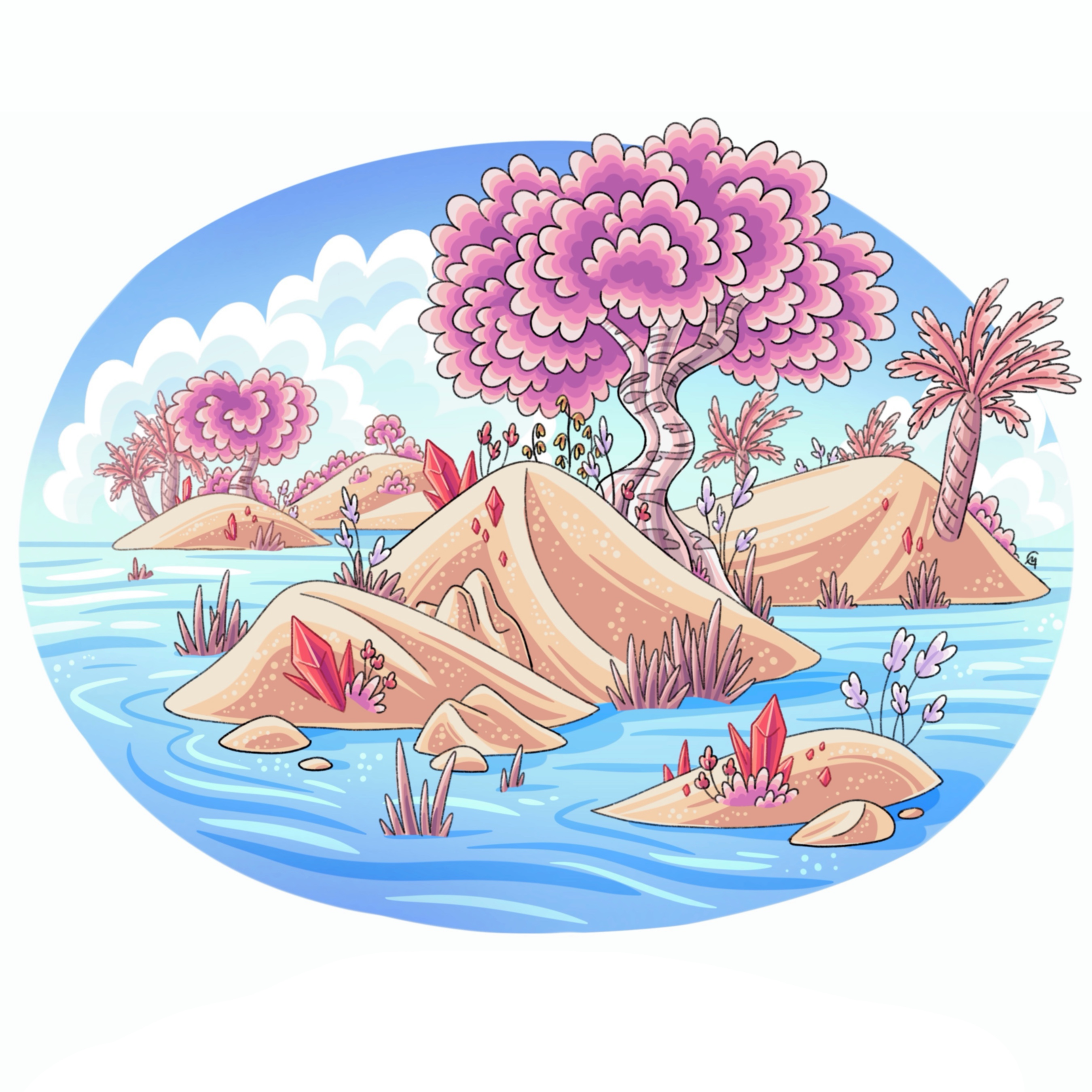
Soot Lake Marshland
In the heart of Pyrriaah is the Great Soot Lake and the Lesser Soot Lakes. Acting as a barrier and transition zone between the Southern Cherry Desert to the south, Cherry Woodland to the west, and the Vermillion Forest to the east, these lakes blend the elements of the biomes into a pink/red sandy marshland. Known for its bright and colorful foliage, Burnbee light shows at dusk, and its overall unique ecosystem, this biome is a marvel of elemental blending between fire and light.
Ginger River Basin
Within central Emberland, on the western side of Ardor Bay, lies the mighty Ginger River Basin that feeds the many rivers of Pyrriaah. This basin hosts hundreds of roaring rivers that break up fiery red plains and patches of vermillion forests. The most notable being the Ginger River whose journey begins in the towering Cayenne Mountain Range and empties into the Pyrra Bay.
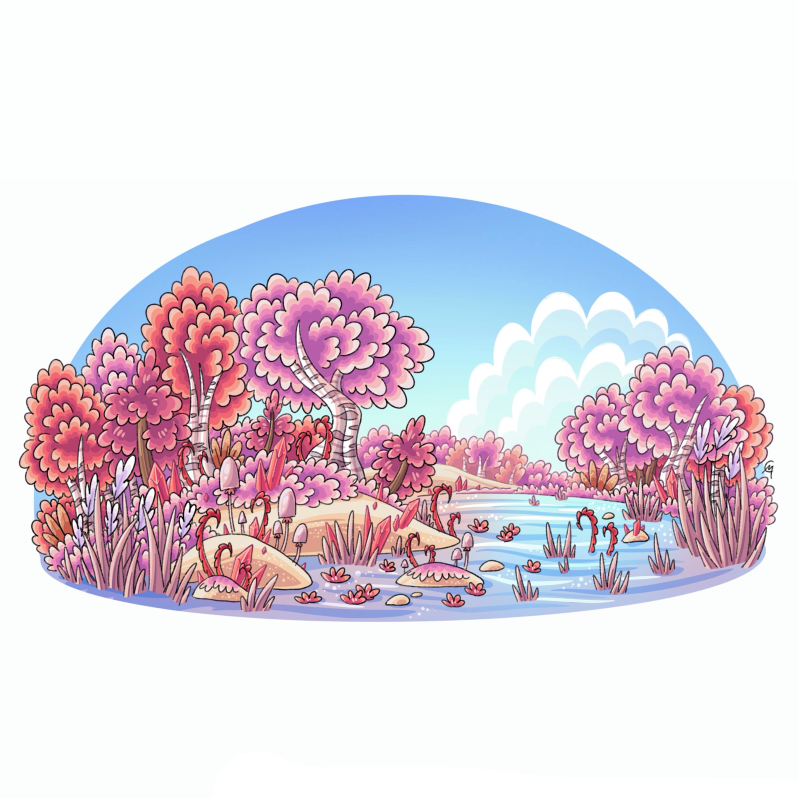
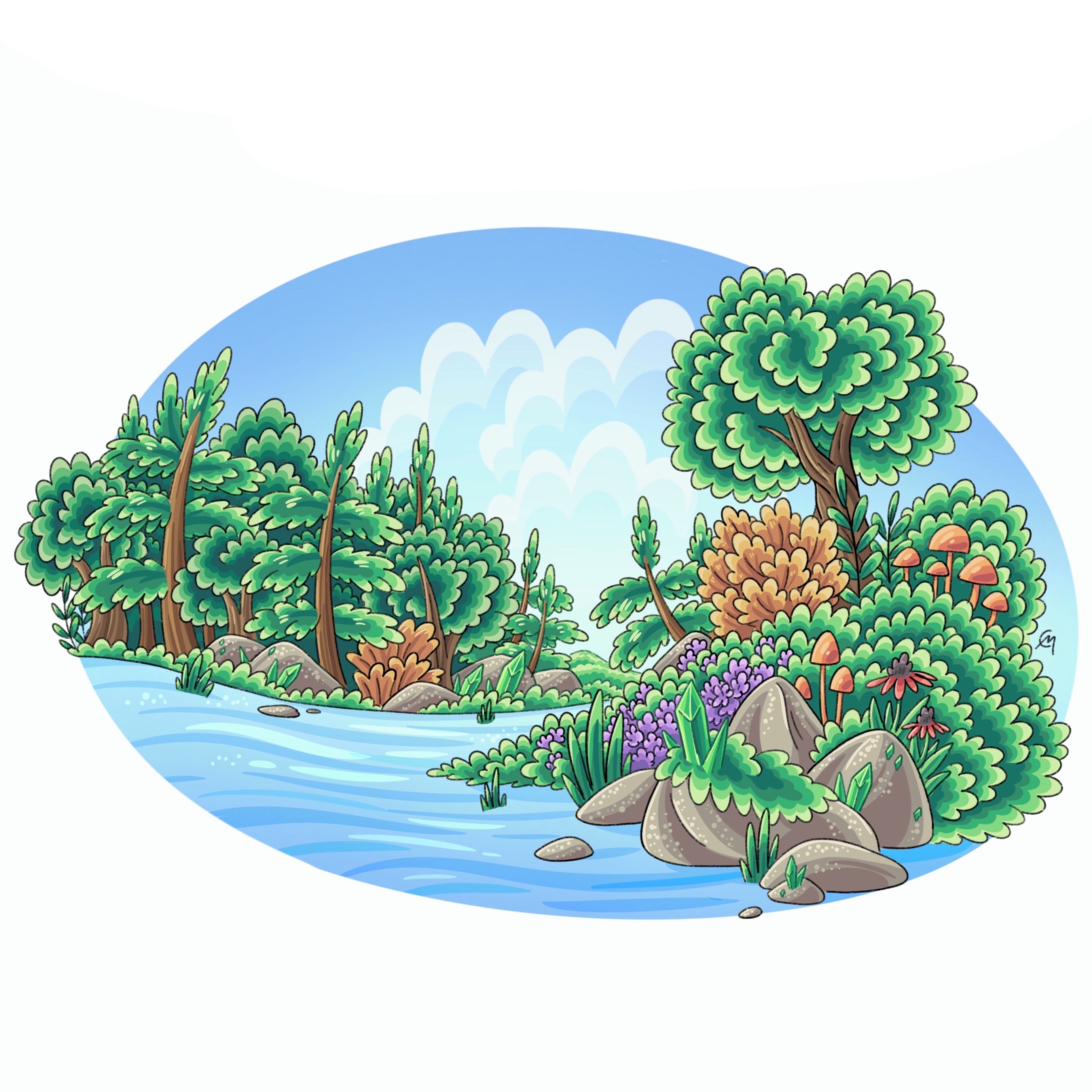
Vermillion Forest
The Vermillion Forest surrounds the lowlands and valleys around the Cayenne mountains, acting as a transition between the sprawling warm Cherry Woodlands and the cooler alpine biomes deeper in Emberland. Known for its bright red foliage, tall pale mushrooms, deep evergreens, and a plethora of red crystals. Like temperate trees within our world, during the autumnal months, they shed their leaves to prepare for winter and the colder months ahead. It has an ideal climate for agriculture and civilization and is where most major cities exist within the countries Vulcune and Pyrriaah.
Vulcunese Forest
On the eastern side of Ardor Bay is the Vulcunese Peninsula. This forest is a subbiome of the Vermillion Forest and features unique hardwoods, bamboo forests, and wetlands not commonly found on the other side of the bay. Due to its geographic position, this forest is subtropical with high precipitation rates, and is highly biodiverse.
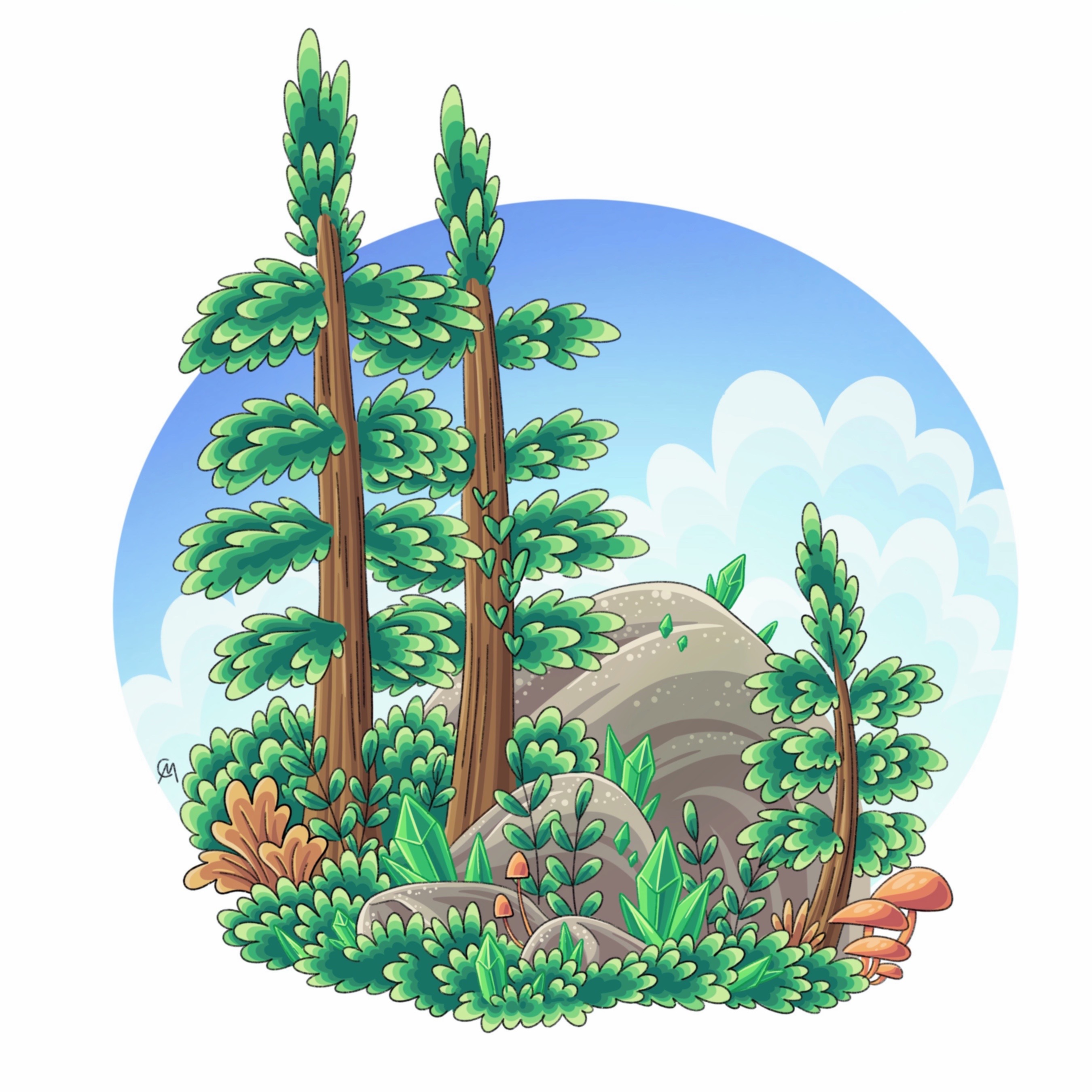
Scarlet Taiga
The Scarlet Taiga is a boreal/alpine forest nestled in the highlands of the enormous Cayenne Mountain Range. Because of the higher elevation, this biome isn’t as diverse in species as the Vermillion Forest, and it features colder temperatures, longer, harsher winters, and more Deep Evergreens and Scarlet Aspens. This biome also features large boulder remnants from past volcanic activity in the neighboring Smoldering Caldera. This has helped the biome become a tourist destination for its famous hot springs, recreation, and breathtaking views.
Smoldering Caldera
The Smoldering Caldera is a steppe-like biome, encompassing much of northeastern Emberland and parts of the Cayenne Mountain Range. Despite the lava plumes, rivers, and other eruptions, this biome stays chilly throughout the year because of being at a higher elevation. Besides the Cayenne Mountains, most of the biome is tectonically inactive and remains an almost barren landscape most of the year. There are stable lava pools//lakes, but they are near the tops of volcanoes and are (for now) contained to remote parts of the northeast. Mt. Pyrope is the tallest volcano within this region and is home to the fire Goddess Pyrope and her God Crystal.
Sekishima
The northeast coast of Emberland is a hot spot separate from the Smoldering Caldera that has new islands emerging every century; however, it's not the tropical, biodiverse islands adored in the south, but it's filled with raging magma that cools once it bubbles onto the surface, forming dark new earth. This biome is very remote and not friendly to visitors; however it provides information on the formation of Terra, tectonic plates, and its relationship to the caves underneath.
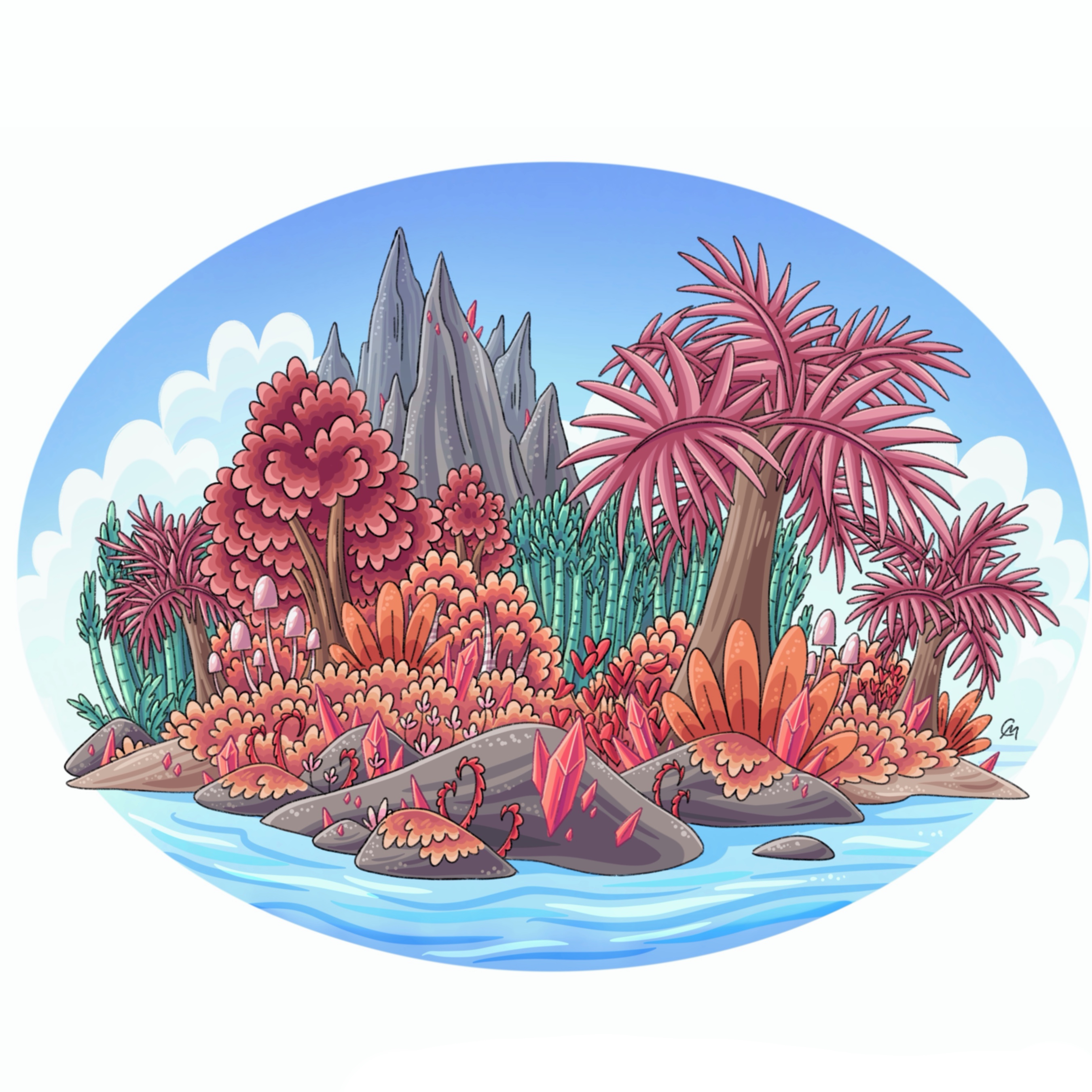
Ruby Islands
The Ruby Islands are an island chain that stretches from the southeastern shore of the Vulcunese Peninsula into the Alluvious Ocean. Highly tropical, remote, and biodiverse, with elements of the Vulcunese Forest with flora and fauna that become more unique to the Ruby Islands the further south you go. Despite its proximity to the Sapphire islands, there is no biome blending. The two island chains remain completely separate and unique within their elemental spheres even though they crossed paths thousands of years ago during the last glaciation.
Aerodona
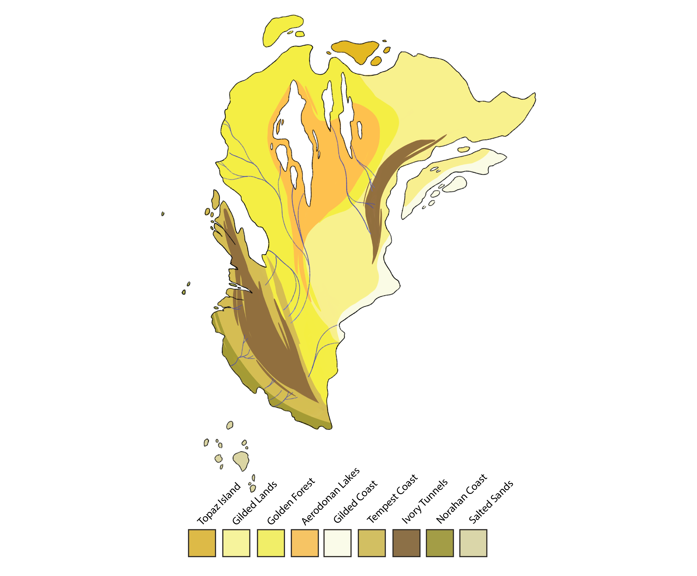
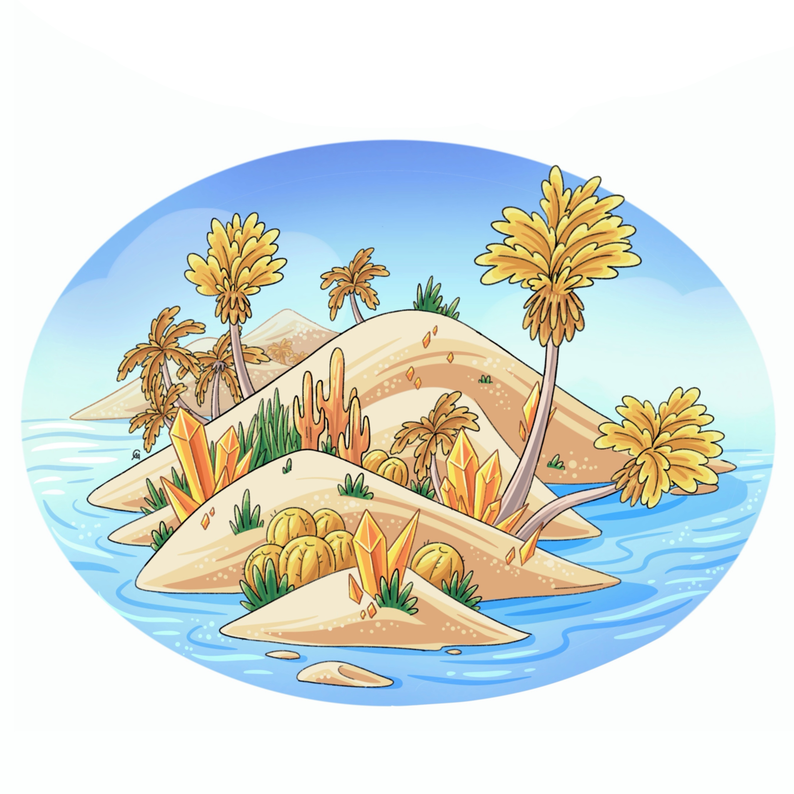
Topaz Islands
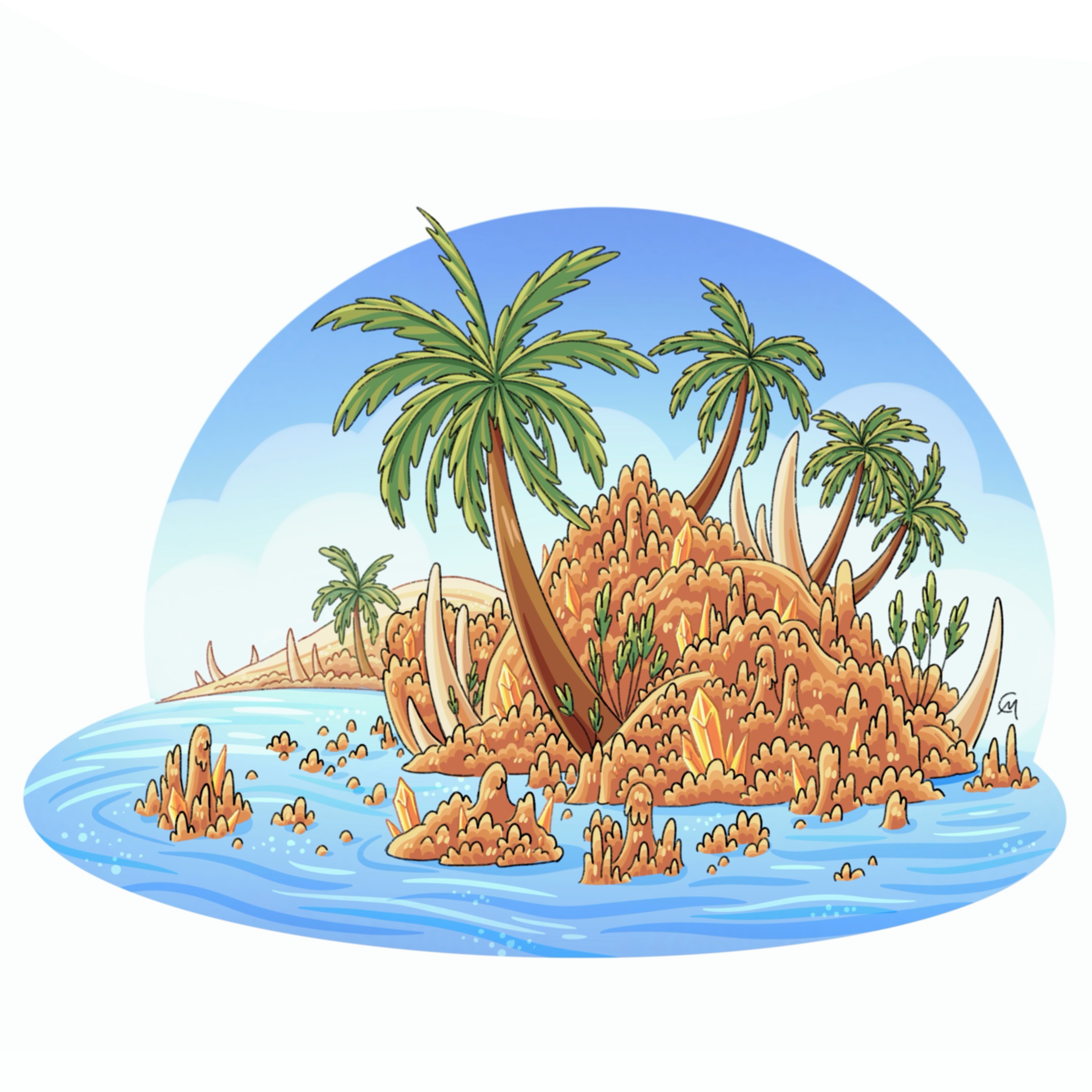
Located off the north shore of Aerdona, the Topaz Islands are a cluster of remote deserted islands that feature towering sand dunes and a variety of bright yellow palm trees and other vegetation. These islands were previously never settled by Terrans due to its lack of fresh water however with modern technology Eastern Topaz Island has turned into a highly rated resort and adventure hub.
Gilded Lands
The Gilded Lands is a hot, dry desert biome full of sand dunes, floating sandy islands, dust storms, and extreme temperature fluctuations. Because of the dry, tropical climate, plant life is sparse, but with the help of oasis dotting the landscape, there are areas filled with lush plant life. Most people who live within this biome live alongside rivers, streams, or oasis to make this desert a bit more hospitable.
Aerodonan Lakes
Within the heart of Aerdona, bordering the hot dry deserts of the west and the tropical forest to the east exists a series of deep lakes that act as a transition zone between a wet and dry climate as well as serves as an end point for the major rivers of this continent. Giant sand dunes intermingle with large swaths of Golden Forest and water ways to form a truly unique ecosystem filled with diverse fauna and flora, and saturated wetlands suited for agriculture and cultivation.
Golden Forest
The Golden Forest is an expansive, lush, tropical forest and featured in Eastern Aerodona. This biome is known for its diverse plants and animals and its picturesque shimmering canopy. Despite its almost perfect look and feel, this humid forest is very dense, hard to navigate, prone to extreme rainfall, and it’s overall harder to grow crops as opposed to the floodplains in the Gilded Lands. This has cemented the Golden Forest as mostly wild and underdeveloped, with a few cities dotted about around shorelines of oceans/lakes.
Gilded Coast
The Gilded Coast is a renowned coastline that has been utilized for seafaring, trade, and fishing for thousands of years, and is a popular entry point into the continent of Aerodona. Despite its towering cliffs and hot, dry climate, this coastline allows for large ships and vessels to land safely. Due to this, many trade routes have propped up throughout the Gilded Desert interior to streamline trade. It also features scattered Golden Forests and an encroachment of the Ivory Tunnel which blends into the hot dry desert within the interior.
Tempest Coast
On the western coast of Aerodona, the southern coastline of the Ivory Peninsula bordering the Brumious Ocean is referred to as the Tempest Coast. Full of canyons, rocky cliff faces, and lush temperate forests, this coastline is beautiful yet unforgiving. Due to its location, the weather and ocean currents can be unpredictable at times, which has made travel around this part of the continent nearly impossible by boat.
Ivory Tunnels
The Ivory Tunnels is the arid steppe encompassing the large Tempest Plateau, and the disconnected Whispy Mountain Range. With its higher elevation and powerful storms raging in and around, the wind has shaped the landscape through erosion and time. This biome is not very habitable to any Terran because of its wild seasonal weather, high altitude, dangerous fauna, and large vast deserted wilderness. Mt. Citrine is the tallest mountain within this region and is home to the air Goddess Citrine and her God Crystal.
Norahan Coast
The southern tip of Aerodona is home to a unique biome which spreads from the southern coast to the Salted Islands in the Brumious Ocean. Full of crystallized salt pillars and glimmering sands, this biome is beautiful and unique and not seen anywhere else. Unlike the Salted Islands which feature the true Salted Sands biome, the Norahan Coast features unique palm trees that can withstand the high salinity and ferocious winds.
Salted Sands
The Salted Sands is the smallest biome of Aerodona, only covering the scattered Salted Islands in the southern Brumious Ocean. It’s unique with its high salt content and with the help of erosion from the air and sea, it’s left with glittery pillars of… salty sand! Despite its look as an arid desert, this biome gets plenty of precipitation, and has some of the most extreme weather on Terra.
Vergund
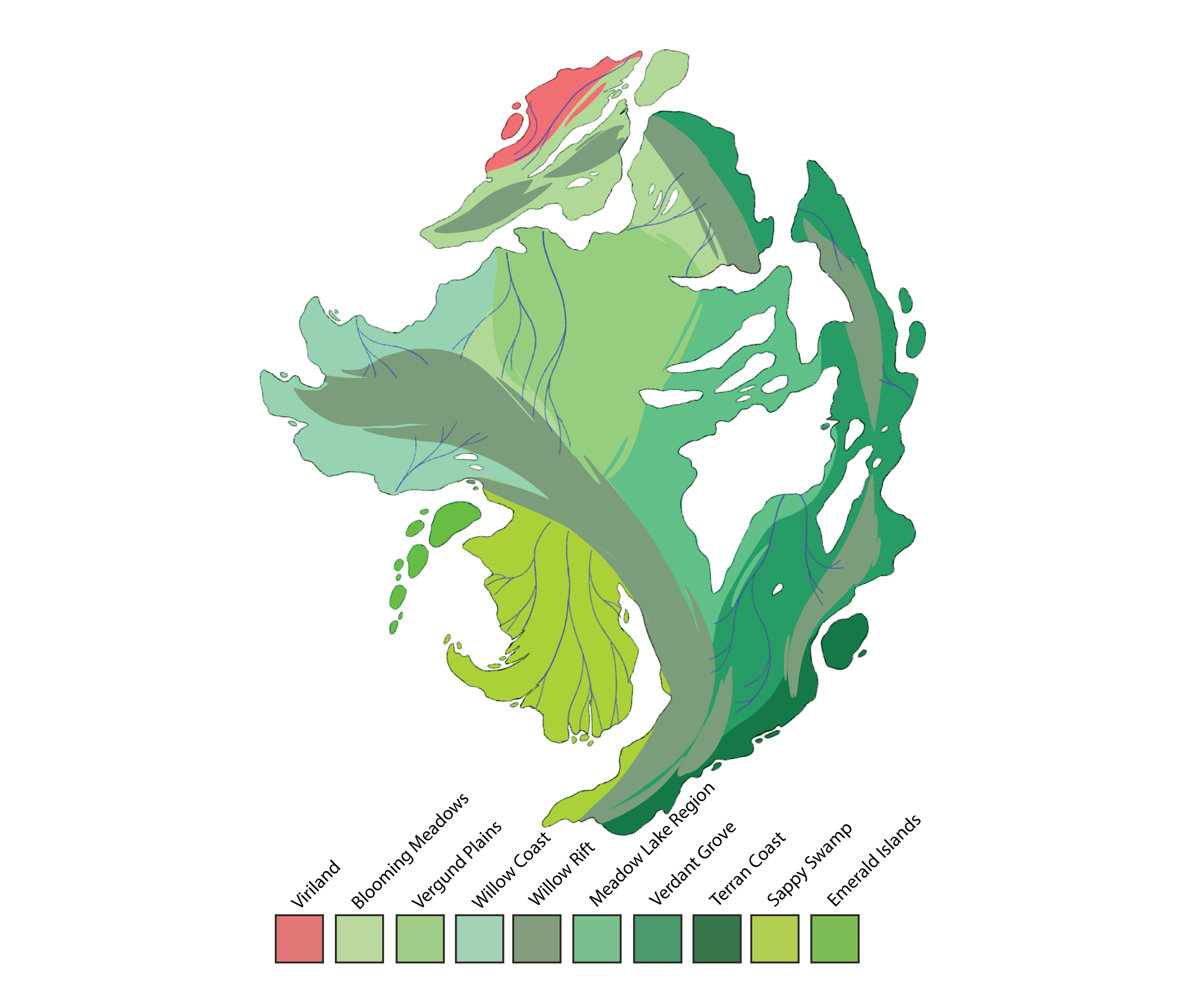
Viriland
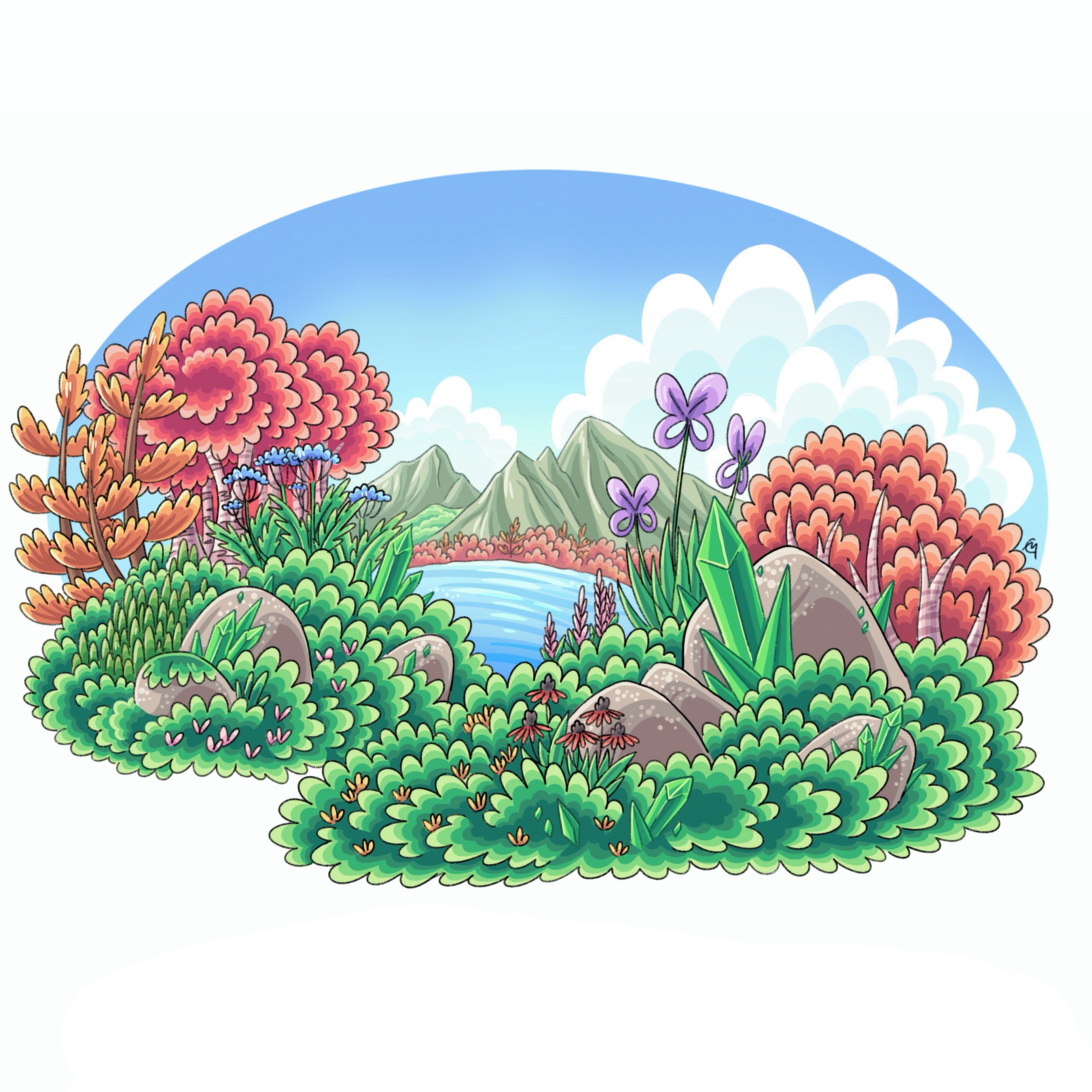
Viriland is a large island located north of the Vergund continent, and is a perfect example of biome/elemental blending with its stark contrast between reds and greens. This unique landscape is home to millions of flower species, which bloom throughout the year and are prized around the world for their wide array of colors. Located at the crossroads between three tectonic plates, this island produces hundreds to thousands of earthquakes a year. Some of these events uplift magma from the caves below, causing wildfires. These fires are important for the ecosystem as they allow a refresh of the environment and provide a healthy landscape for Viriland’s flowers to sprout.
Willow Coast
Wrapping around the northeastern coast of Vergund, bordering the Flint Sea, lies a shallow rocky shore known as the Willow Coast. Named after the late wife of the God Aventurine, mother of the legend Evergreen, this landscape features jaw-dropping rolling hills, striking rocky beaches, unique and diverse wildflowers, and willow trees that sway with the oceanic breezes.
Vergund Plains
In the northern half of Vergund, between the Emerald mountain range to the west and the Chryso Mountain range to the east, exists large sprawling plains and grasslands. These grasslands are home to a network of rivers and streams that begin their journey at the top of these towering mountains and drain out into the Viril Strait in the northwest, Olive Bay to the northeast, and deeper into the great lakes of Vegund. Due to the amount of water running through this region, it is one of the most fertile locations for agriculture and is said to be the birthplace of civilization in the Eastern Hemisphere. Large boulders dot the landscape, with most having migrated from the mountains, traveling along with rivers or glaciers from bygone days.
Blooming Meadows
In northern Vergund and the northern island of Viriland, the Blooming Meadows dominate with its bountiful flowers, rolling hills, small shrubbery/woodlands, and large boulders from years past dotting the landscape. It’s flat, features few trees, and is within proximity to some of the largest rivers and lakes on Terra, this biome has played a dominant role in the development of agriculture and civilization.
Willow Rift
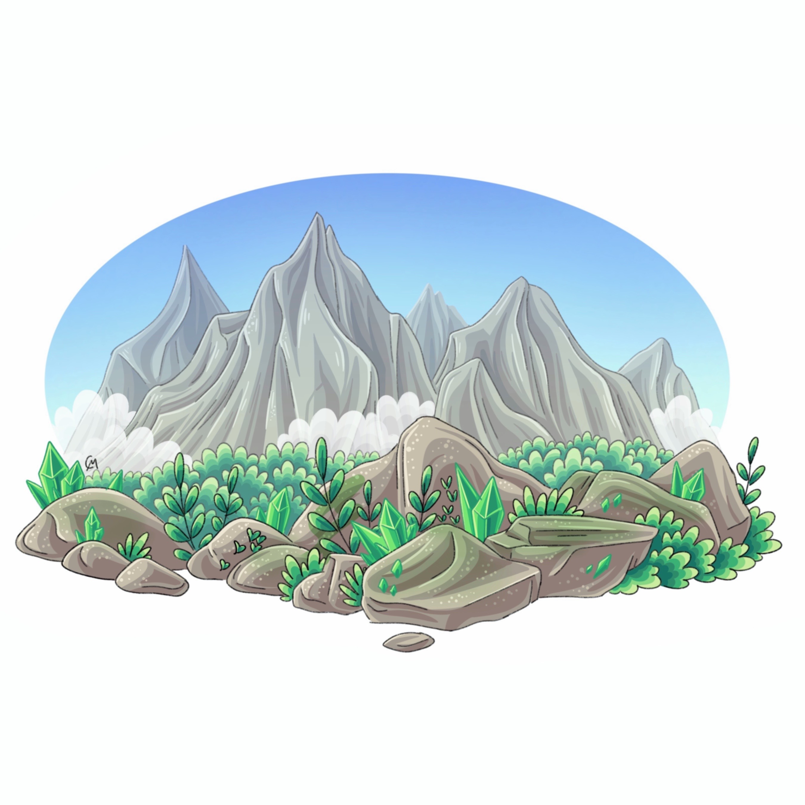
Known as the “Great Mountains of Terra” this biome is home to the great Emerald Mountains in the west and the smaller broken up Chryso Range on the east side of Vergund. These ranges are home to the tallest mountains on the planet with some towering above 9,000 m. Due to its higher elevation, it’s a lot colder in average temperature and has less biodiversity than surrounding biomes. This biome, especially in the country Arbasia, is extremely sacred and is a source of magic from Panacea (Goddess of Terra). Mt. Aventurine is the tallest mountain within this region and is home to the ground God Aventurine and his God Crystal.
Meadow Lake
Located in central Vergund, Meadow Lake is the largest freshwater lake on Terra and serves as a blend between rolling plains in the northwest and the hardwood forests in the southwest. This freshwater basin not only includes Meadow Lake, but also hundreds of other lakes and tributaries filled with runoff and sediment from the two major mountain ranges. This lake is home to unique species, lively fisheries, and forested beaches.
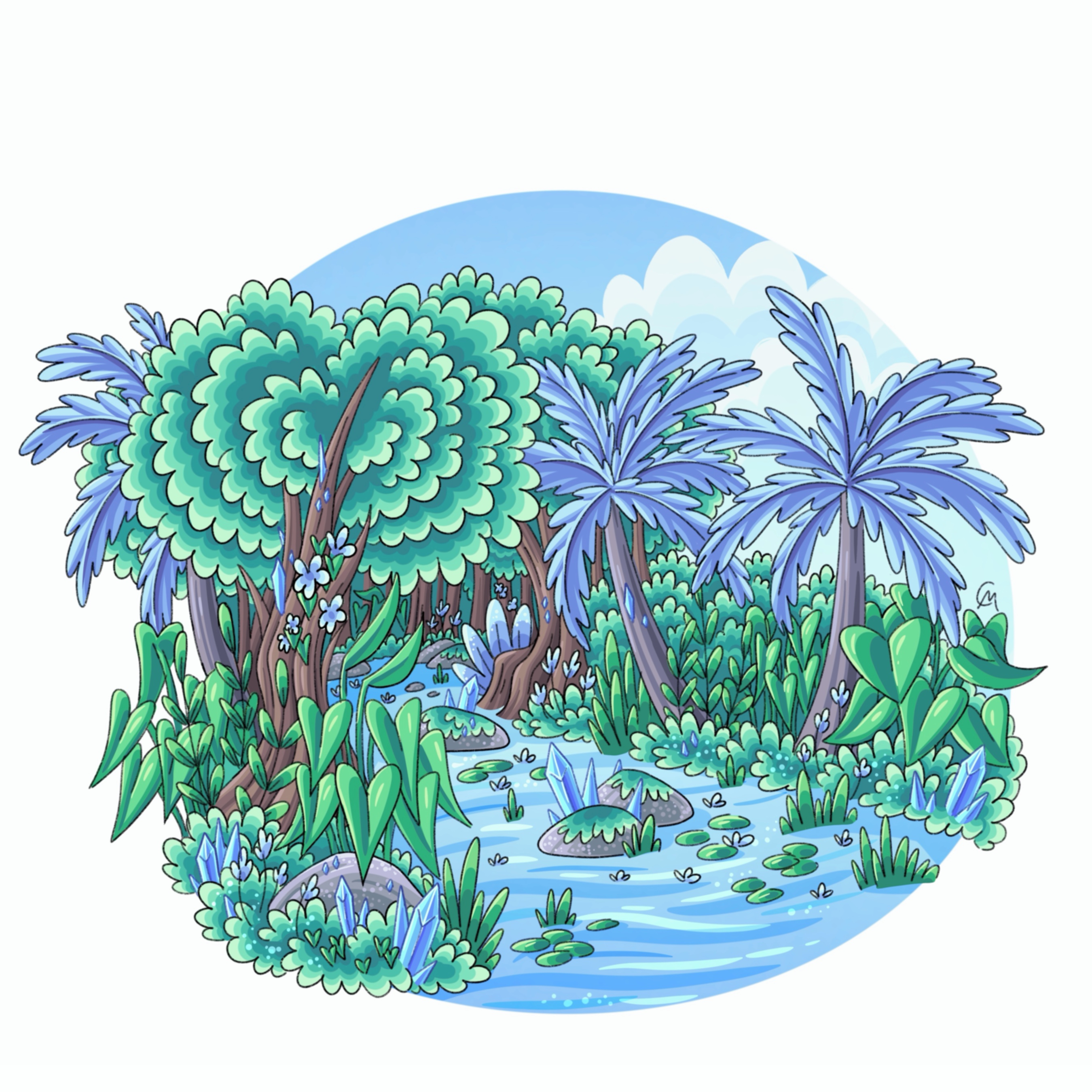
Verdant Grove
The Verdant Grove is a large, equatorial, humid rainforest that dominates the eastern side of Vergund with the largest concentration in the south. This biome is home to world’s tallest trees with some towering over 400ft. Since the majority of people live within the meadows, and alongside rivers/lakes, this biome is largely wilderness with a few cities and settlements scattered around in valleys or along lakefronts. It’s most famous for its large megafauna, diverse ecosystem, medicinal plants, and oil/tar pits.
Terran Coast
Along the southern shore of Vergund, bordering the Panacea Meadows and the southern edge of the Emerald Mountain Range, is the Terran Coast. This coastline serves as an extension of the previously mentioned Panaceal Plains, which are filled with blossoming Panaceal plants alongside dense hardwood forests. This coastline is strictly prohibited from seafaring, trade, and fishing to protect the connection between the land and the Goddess of Terra, Panacea.
Sappy Swamp
Southwest of the Emerald Mountains in the Greater Anaconda Subcontinent exists the Sappy Swamp. Because of its proximity to the ocean and mountains blocking air currents, this humid, tropical rainforest is dense, wet, and hot most of the year, unlike the other biomes in Vergund. This biome is super diverse and thousands of different species of plants, animals, and fungi call it home. It features an extensive network of mangrove like trees throughout the delta holding together soil and preventing massive flooding events during the wet season. Due to its rough, almost hostile climate, there are only a few regions hospitable enough to establish cities and agriculture.
Emerald Islands
Off the west coast of the subcontinent, Anaconda, south of the Emerald Mountains, exists the island chain colloquially known as the Emerald Islands. These tropical islands are known for its scattered waterfalls, dense, lush rainforests, and interconnected oceanic swamp between the islands. Despite its resemblance to the Sappy Swamps found all over the subcontinent, these islands harbor a unique ecosystem not seen elsewhere.
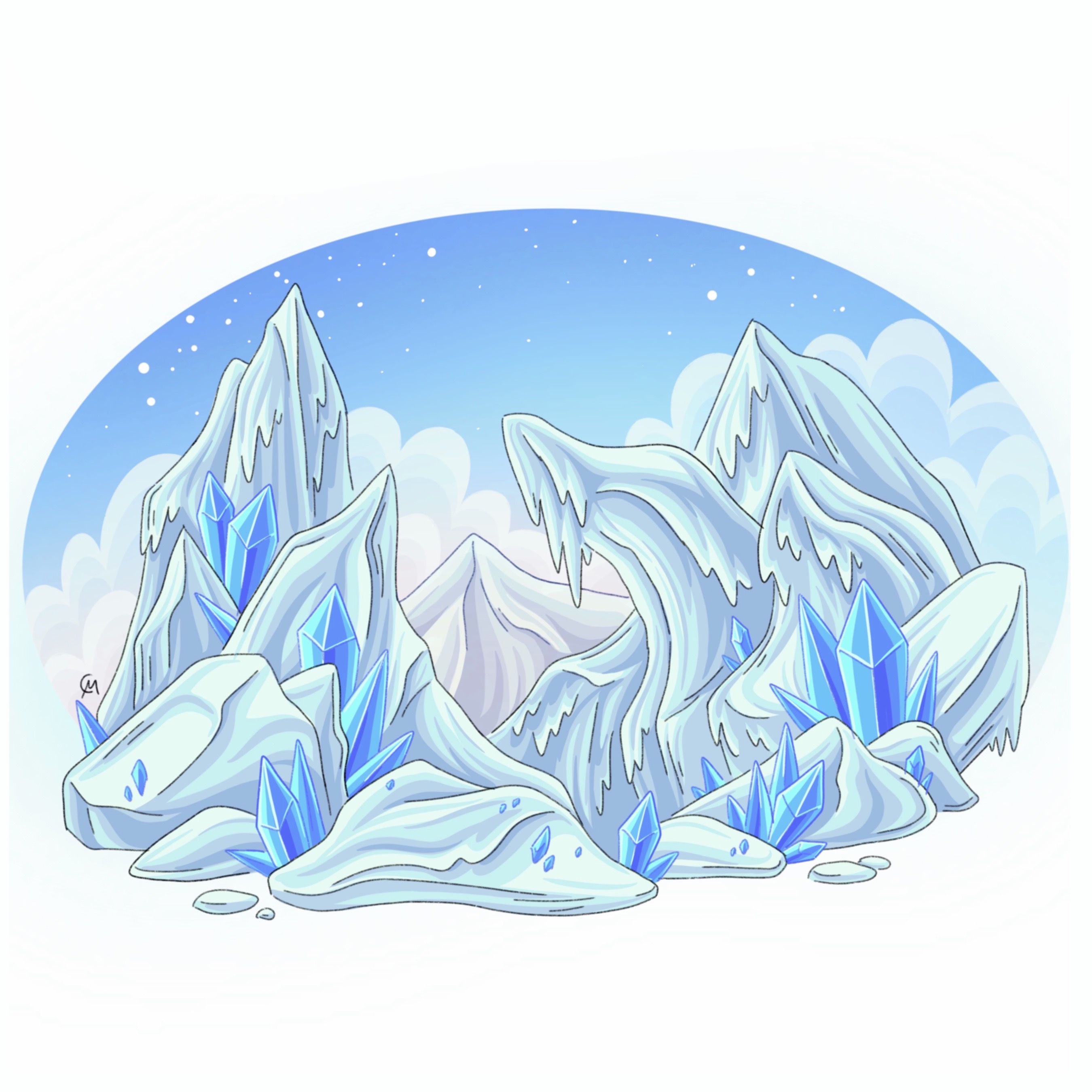
Glacilea
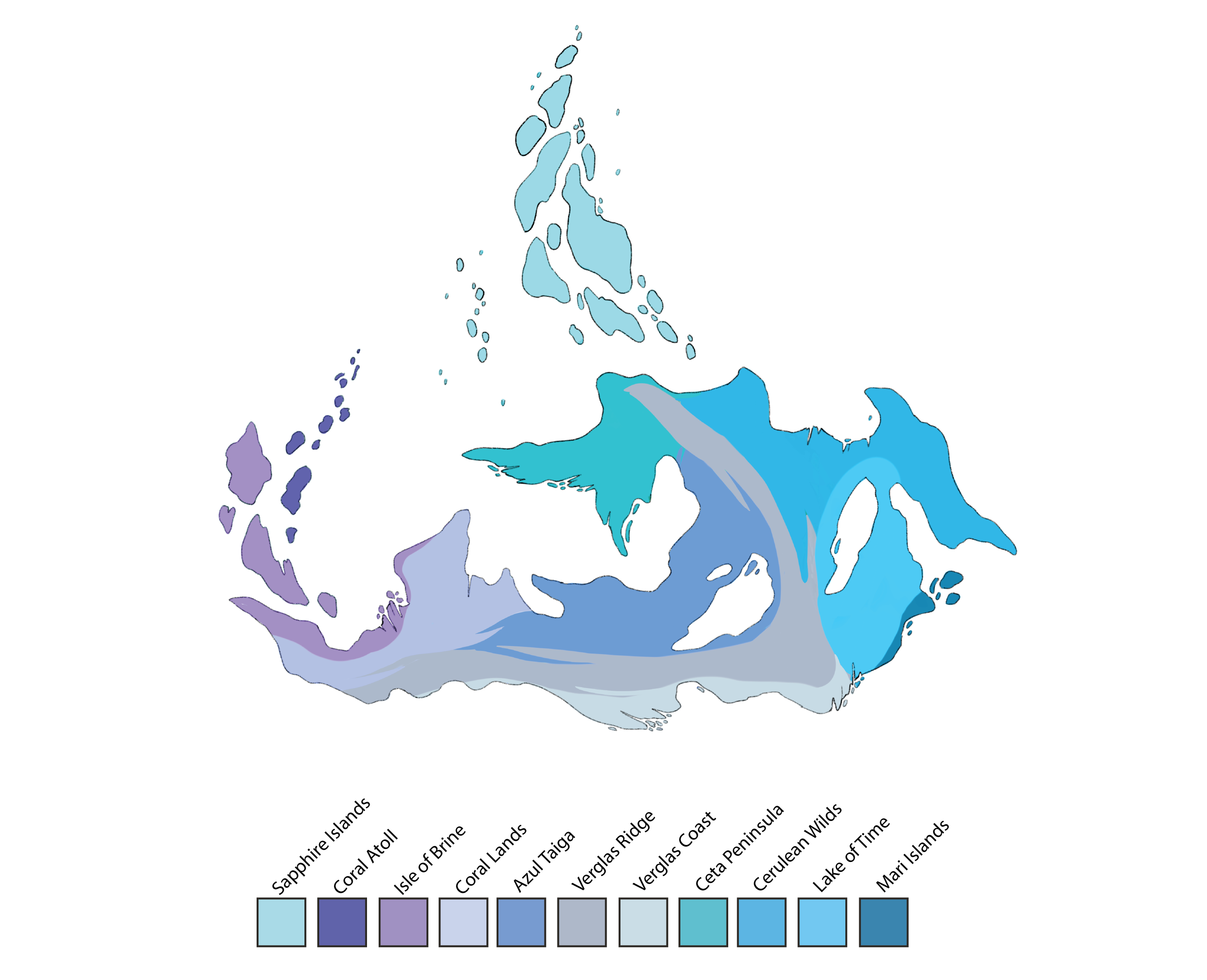
Sapphire Islands
The Sapphire Islands are a large island chain centered between the Alluvium Ocean and the Siroccious Ocean. Continentally, it’s a part of the southern continent Glacilea, however it has stretched so far north that the Aeon Caves have formed entrances into the island, while the Void Caves begin to close up under the moving magma plume. This isn’t the first time this region has “clashed” with others as the last glaciation saw the merge between the Sapphire Islands and the Ruby Islands up north. Even with the influence of nearby biomes, the Sapphire Islands has a distinct ecosystem with unique species not found anywhere else. The biome is a humid tropical jungle with a rockier shoreline in the north and a smoother, beachier shoreline in the south. As it sits upon a magma plume, it has frequent eruptions/magma flows and is continually forming new islands every year.
Coral Atoll
On the Northwestern coast of Glacilea exists an incredibly bright, colorful, and diverse reef system alongside a vibrant coast. Coral Atoll refers to the islands/coastlines within/around the Glacial Sea. This biome is distinct from both the Sapphire Islands, and inner mainland Glacilea and features a wildly unique landscape, and ecosystem that only exists there. The pale blue almost white sands/minerals dominate the landscape, whereas colorful coral/plants cover the sea floor.
Isle of Brine
Southeast of the scattered Coral Atoll, the Isle of Brine is a series of large temperate islands off the coast of Western Glacilea. These islands are known for their lush forests, full of deep blue trees and striking palms closer to the coasts. Despite its tropical appearance, it's in a temperate climate where it experiences a cold winter that’ll cover this paradise in layers of snow.
Coral Lands
In the mainland of Western Glacilea is a vast landscape of rolling hills, sparse tree growth limited to conifers and deep blue deciduous trees, and features unique white minerals. This landscape was once covered in a mile thick ice sheet which when it started to retreat to the mountains left behind a scarred landscape full of rivers, lakes, and streams. This makes the coral lands the highest producer of fresh water, and despite its short growing season has allowed for agriculture to flourish
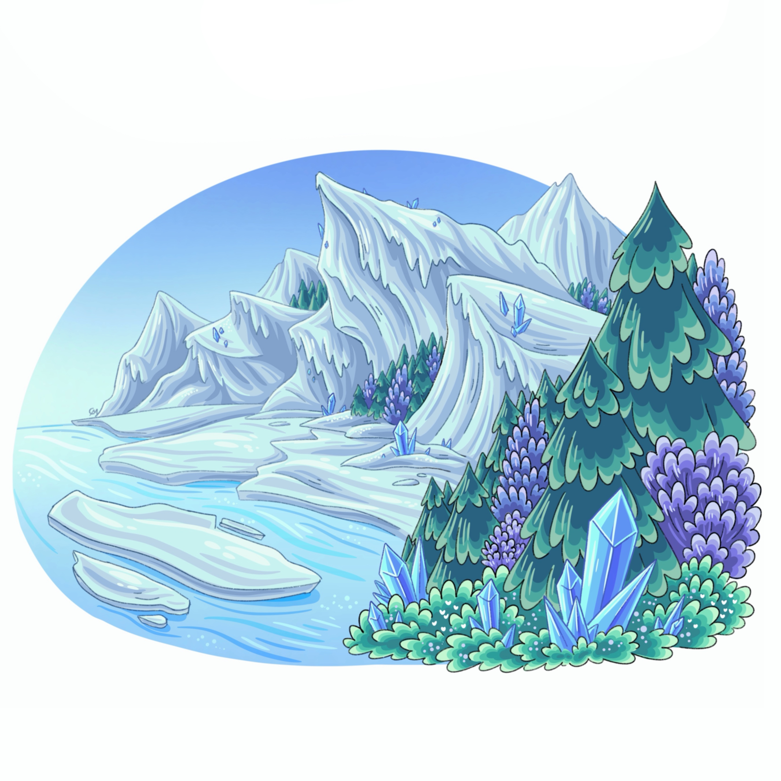
Azul Taiga
Situated between the Coral Lands and Verglas Glacier lies the Azul Taiga, a cold boreal/alpine biome. Its long, cold winters, high snowfall, blizzards, and scattered glacial remnants characterize and make it unique amongst the neighboring warmer biomes. Because of the extreme winter temperatures and higher elevation (makes for mild summers), this biome isn’t as diverse and is harder to cultivate than neighboring biomes.
Verglas Ridge
Dominating central Glacilea, the Verglas Ridge is home to the enormous Verglas Glacier. This ancient glacier has been slowly shrinking over thousands of years due to a change in climate (colder Terran climate to a more moderate climate), but it still dominates the central landscape and its ecosystem is still thriving. Due to the complex terrain/hostile environment, most organisms find themselves along the southern coast or in small pockets around the base near bodies of water. The top/peak is completely uninhabitable except for a few creatures that have adapted to the dry, cold desert.
Verglas Coast
At the bottom of the world, nearing the south pole, is a coastline known for its harsh polar climate, long, dark winters, and unique flora and fauna adapted to its extremes. Covered in glaciers and ice sheets for most of the year, but in summer the ice retreats revealing a permafrost covered tundra. Travel to and from this coastline is blocked from the mile high glaciers to the north, and the ice sheet floating in the ocean to the south. It is a remnant of the colder temperatures and glaciation in the past and is the last place on Terra to host permanent ice sheets.
Ceta Peninsula
Across the Gulf of Azur, in Northern Glacilea, protruding to the west, is the large peninsula, Ceta. The Ceta Peninsula is an uninhabited tropical jungle full of diverse flora and fauna, waterfalls, rivers and streams, and is one of the last places on Terra untouched by terrans. This is due to a multitude of factors: dangerous terrain/weather/wildlife, poor soil quality, and glaciation that has blocked it off from the jungles to the East. Thanans native to the south believe it to be a sacred area, a wild place, and must remain untouched lest you anger the Goddess Azurite.
Cerulean Wilds
On the northeastern half of Glacilea exists a lush, tropical jungle that was isolated from the other Glacilean biomes by the large Verglas Glacier during the last glaciation. Because of its location and proximity to the warm equatorial oceans, the Cerulean Wilds experiences the most rainfall and tropical storms out of any biome besides some regions in lower Aerodona. Most of this biome is flat and sits among raging rivers/deltas, which makes it productive for agriculture and civilization. This biome is also home to the highest number of waterfalls on Terra, mostly concentrated further inland near glacial melt.
Mari Islands
Off the Southeastern shore of Glacilea, as glaciers began to retreat to the mountains carved out the Mari river which drains out into Khadari Bay. This bay and its two islands, colloquially known as the Mari Islands, is a temperate landscape where there is encroachment of both cold resistant tropical plants from the North, conifers from the mountains, and dark soil/rocks from the caves below. Acting as a blend between these different ecosystems, this biome is still changing and developing, and is an example of life’s adaptability to this “new” land.
Lake of Time
North of the Mari river basin, is the largest lake on Glacilea, a glacial lake formed from the melting runoff as the weather warmed. This lake is said to be a gift from Azurite, as when terrans initially migrated to this continent, most of it was still under glaciers and ice, however as these terran’s blood turned blue this glacier lake began to fill up. The northeastern side of the lake is an extension of the tropical Cerulean Wilds filled with lush canopies, scattered rivers and waterfalls, while the southwest side hugs the towering Indigo Mountains and its glaciers featuring conifers, dark rocks and soil, as well as cold-resistent deciduous trees that adapted to the cooler climate.
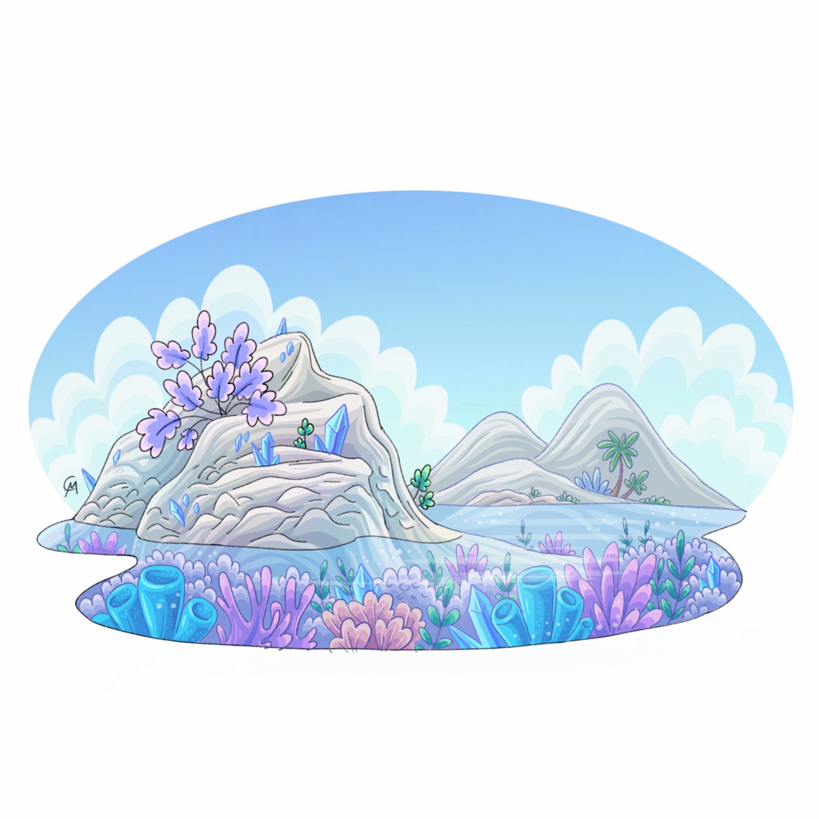
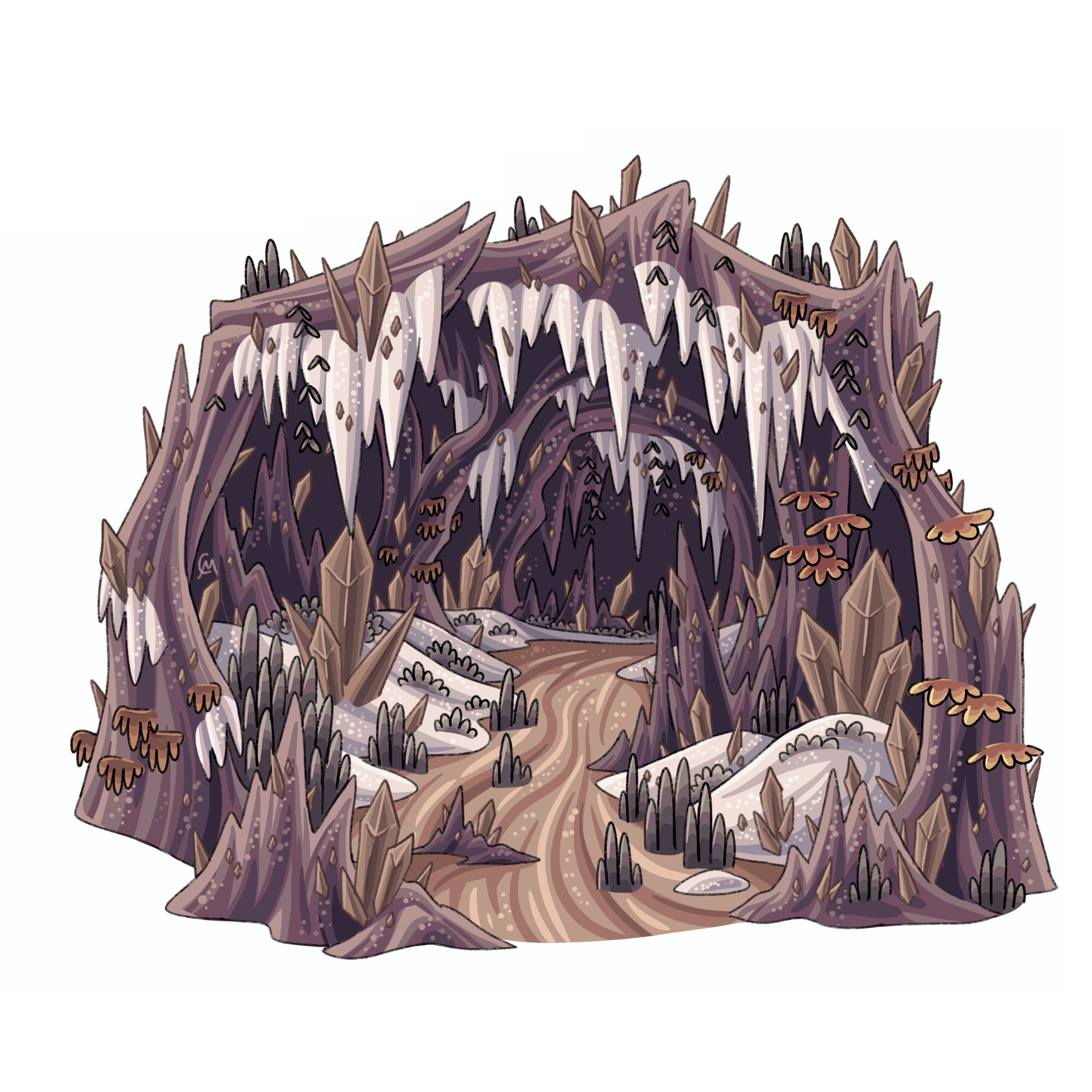
Void Caves

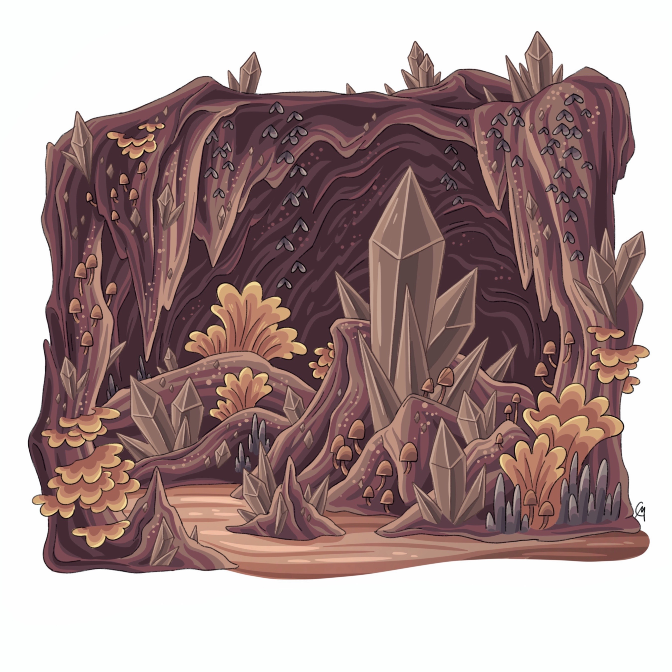
Void Caves
The Void Caves are an expansive cave system that exists underneath the southern hemisphere. Void caves, known for its low-light, dark tunnels and caverns, a plethora of giant brown/black crystals, distinct cave plant/animal life and the prevalence of dark spirits is a hidden world full of silence and darkness. These caves stretch millions of miles, bordering three continents, with many undiscovered and unexplored branches. Every cave, branch, cavern is unique and not found anywhere else, with varying temperature, humidity, and biodiversity.
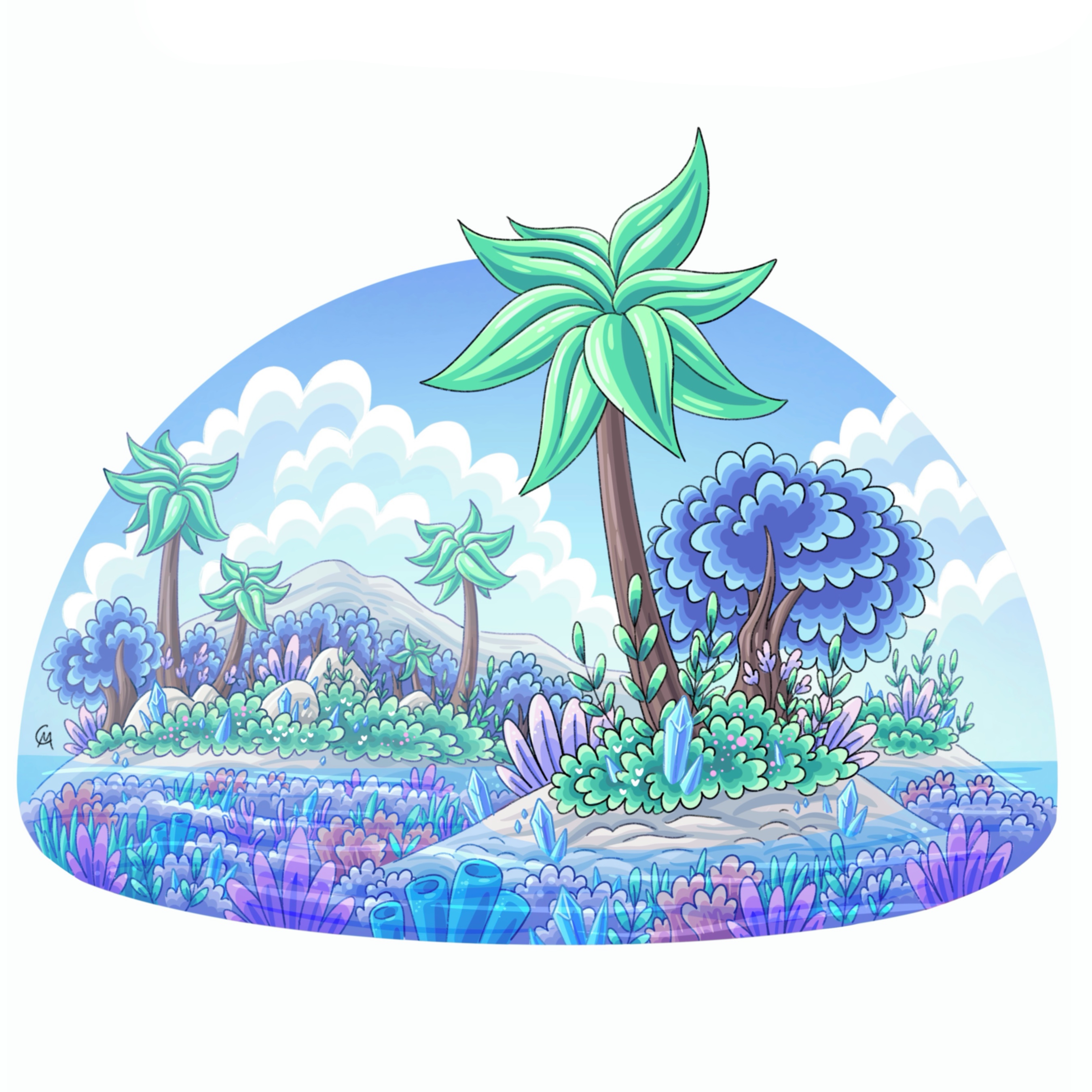
Voids
Voids are giant subterranean cavities that exist within Terra’s southern hemisphere. They can range from a few miles to hundreds of miles across. Because of their sheer size, these voids can host an atmosphere of their own where it’s nearly impossible to look up and see the subterranean ceiling. Voids are typically covered in a blanket of dark “grass”, scattered ponds/lakes, and are filled with bustling spirits. They reflect the day/night time cycles seen on the surface as spiritual activity brightens the “sky” during the day and darkens it at night. These biomes are where most people in The Void Caves (the country) live as major cities have taken advantage of the sheer size and geography of these Aeons which made it easy to grow and develop into cities. The largest void, the Umbra Void, is home to the dark Goddess Obsidian and her God Crystal.
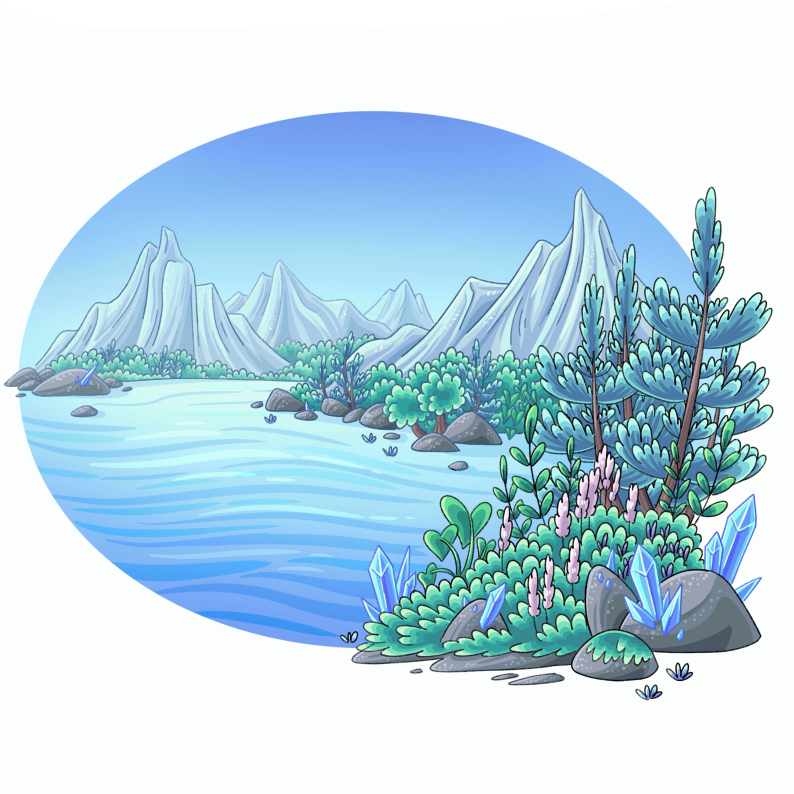
Indigo Cluster
The Indigo Cluster is a cluster of voids and caves located underneath the continent Glacilea. This cluster is known for its frigid temperatures, permafrost covering the ground, icicles dangling above, and frozen streams and waterfalls that carve out caverns and ravines. Despite its seemingly extreme environment, this cluster is extremely suited for life as all of its water and ice originate from the Verglas glacier on the surface, slowly leaking and draining into entrances over thousands of years. During the peak of the hottest season, Azurina, this frozen landscape melts, producing millions of gallons of freshwater that flows throughout the void caves alongside the melting glacier settled above on the surface. This allows the migrations of many fauna throughout the caves towards the surface to take advantage of the melt.
Golden Cluster
The Golden Cluster is a cluster of voids and caves located underneath the southern half of the continent Aerodona and the far western side of the continent Glacilea. This cluster is known for its ravines and deep caverns that are covered with ancient sandstone that has been slowly pushed into the caves over millions of years. Unlike the Ivory Cluster of the Aeon Caves, the wind cannot be pushed into the entrances due to the Tempest Plateau's growth, blocking wind, preventing erosion of the cave’s walls as well as surface sediments. This has allowed this cluster to remain nearly untouched before Terrans migrated beneath. Lacking fresh water, this dry cluster is hostile to most life and is mostly populated by dark spirits and its decomposers.
Jade Cluster
The Jade Cluster is a cluster of voids and caves located underneath the southern half of the continent Vergund and the far eastern side of the continent Glacilea. This cluster is known for its overgrown, lush caverns, filled with unique flora and fauna which is decomposed by giant, scattered fungi. This cluster shares minerals and carbon deposits that appear on the surface, but due to tectonic activity sections have been buried underground. These carbon deposits fuel the cycle of overgrowth and excessive decomposition which keeps this carbon locked within the rocks. Due to international conflict, almost all entrances to this cluster are cut off from the surface(in Arbasia’s case, destroyed), with only a handful of entrances deep in the dense jungle of Greater Anaconda, and a few Vincan entrances that can only be accessed with permission.